
✨ Highlights:
- 🏔️ The world’s highest paved highway with average altitude over 4500m, crossing the Ngari plateau of Tibet
- 🏞️ Iconic landmarks: Pangong Lake, Mount Kailash, Manasarovar Lake, Zanda Earth Forest, Jieshan Daban
- 📋 Essential travel checklist: Tibet permit, border pass, high-altitude preparation, fuel & accommodation planning
- 🗓️ Best travel season: June to September, stable weather and open road conditions for G219 Ngari self-drive
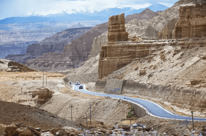
The Xinjiang Tibet Highway, also known as National Highway G219, is widely celebrated as one of the most spectacular wilderness road trips on Earth. Its Ngari segment, stretching from Yecheng in Xinjiang into western Tibet’s Ngari prefecture, is the crown jewel of this epic trans-border route. Travellers who take on this Xinjiang Tibet Highway G219 Ngari route travel guide are rewarded with endless panoramic views: snow-capped Himalayan and Gangdise peaks, turquoise alpine lakes, ancient badland formations, vast no-man’s-land and the profound spiritual culture of western Tibet. This detailed guide will walk you through route planning, top attractions, travel paperwork, altitude sickness on G219 Ngari route, driving rules, accommodation and practical tips to help you prepare for this once-in-a-lifetime highland adventure.
What is G219 Ngari Route?
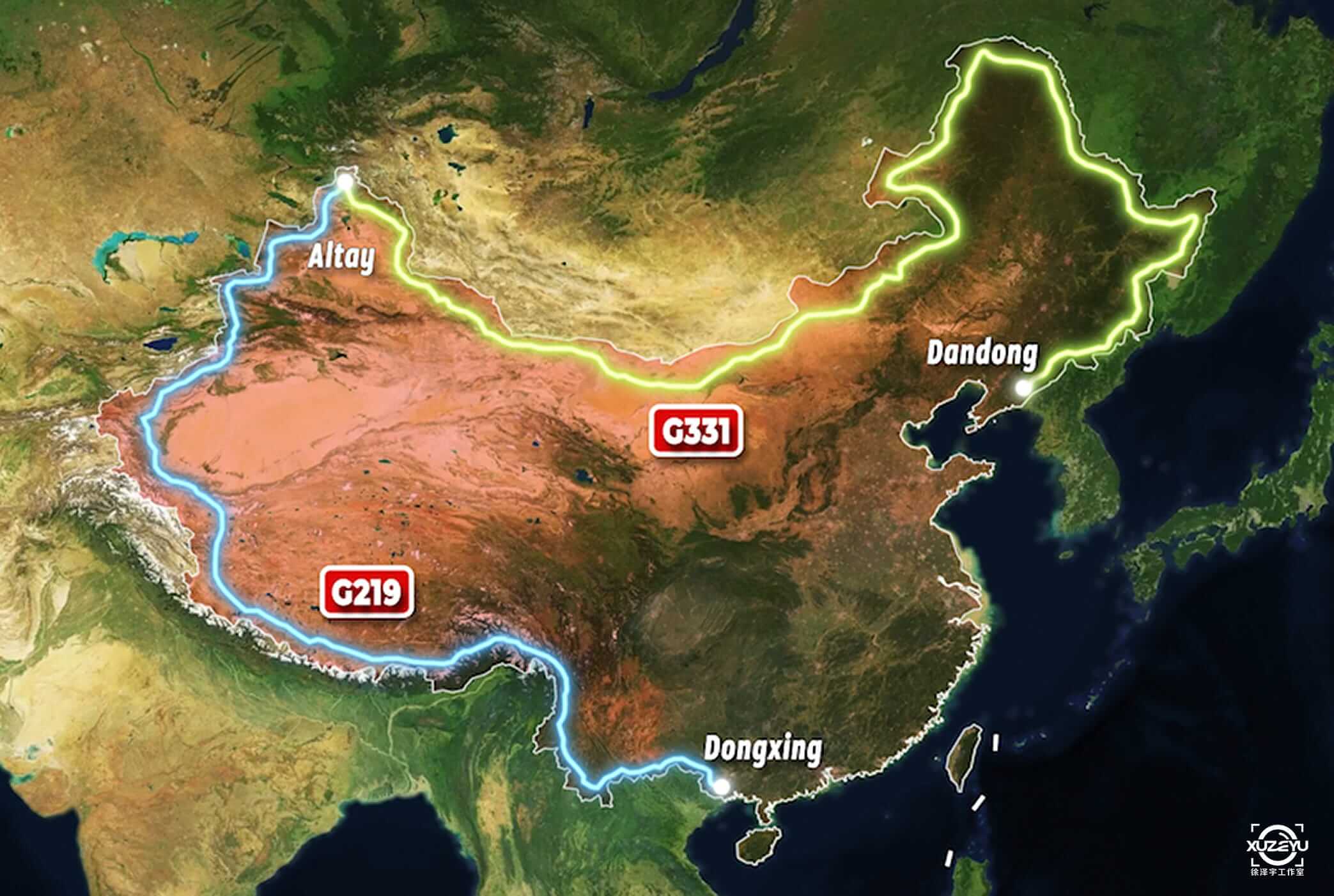
National Highway G219 is China’s longest national highway. The Xinjiang-Tibet section starts at Yecheng, Xinjiang, winding southwards across the Kunlun Mountains, Karakoram Mountains and into Ngari, Tibet. This legendary segment is famous as the highest paved highway in the world, with multiple mountain passes over 5000 meters and an average altitude above 4500 meters.
Many travellers wonder how long is G219 Ngari route. The classic G219 Ngari route has two directions. The northbound itinerary starts in Ngari and heads to Yecheng, Xinjiang. The more challenging southbound route departs Yecheng and climbs rapidly from around 1300m elevation straight into the high plateau of Ngari, crossing famous passes including Qitai Daban, Hongtu Daban and Jieshan Daban, the border marker between Xinjiang and Tibet. After Jieshan Daban, you enter Ngari territory, passing Pangong Lake before arriving at Shiquanhe, the capital town of Ngari prefecture. From Shiquanhe, G219 continues south to include Mount Kailash, Lake Manasarovar and Zanda Earth Forest, forming the complete Ngari sightseeing loop.
Unlike popular low-altitude tourist routes, the G219 Ngari highway runs through sparsely populated highland wilderness. That is why this high altitude road trip requires thorough preparation before departure. Ngari plateau sightseeing rewards patient travellers with raw, untouched natural scenery that few visitors get to witness.
Recommended 10-Day Itinerary for G219 Ngari Route
This classic itinerary follows the southbound direction from Yecheng to Ngari core scenic areas. You can shorten or extend it based on your travel pace.
– Day 1: Yecheng (Xinjiang) → 324km → Dahongliutan. Elevation rises quickly today. Rest early, avoid heavy exercise and alcohol.
– Day 2: Dahongliutan → Qitai Daban → Hongtu Daban → Jieshan Daban → Ritu County. Cross multiple 5000m+ passes. Stop briefly for photos, do not linger at high-altitude passes.
– Day 3: Ritu County → Pangong Lake → Shiquanhe. Visit Pangong Lake, the famous long lake with fresh water in the east and salt water in the west. Stay overnight in Shiquanhe, the main supply hub of Ngari.
– Day 4: Shiquanhe → Zanda County. Drive to Zanda Earth Forest, the spectacular eroded landform carved by thousands of years of river erosion. Overnight in Zanda.
– Day 5: Zanda → Guge Kingdom Ruins → Baga Township. Explore the ancient Guge civilization ruins at sunrise. Continue to Baga near Mount Kailash.
– Day 6: Baga Township → Mount Kailash & Lake Manasarovar. Spend the whole day visiting the sacred mountain and holy lake, the spiritual heart of Ngari.
– Day 7: Baga → Zhongba. Drive along the southern stretch of G219, admire endless plateau grasslands and small alpine lakes.
– Day 8: Zhongba → Saga. Slow travel on the high plateau, watch wild yaks, Tibetan antelopes and other plateau wildlife.
– Day 9: Saga → Pegu Tso. Relax by the lakeside and enjoy unobstructed views of Himalayan snow peaks.
– Day 10: Pegu Tso → Shigatse. End your G219 Ngari adventure and connect onward to Lhasa.
Must-See Attractions Along G219 Ngari Route
Pangong Lake
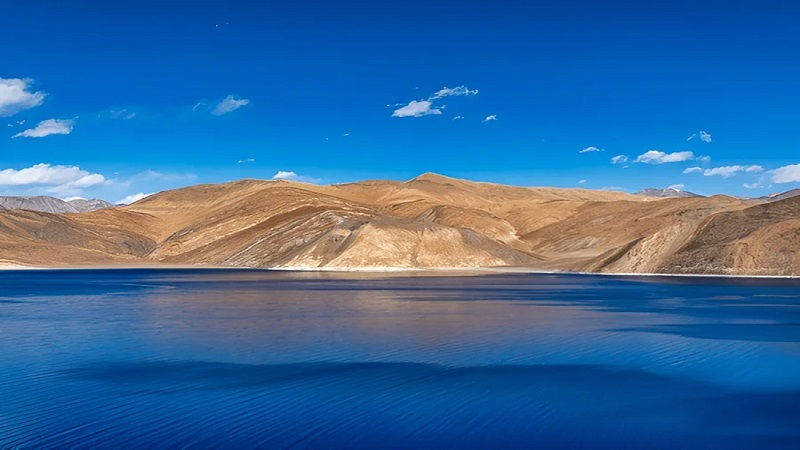
Pangong Lake sits on the border area between Xinjiang and Ngari Tibet. The long narrow lake stretches more than 150km. Its unique feature is that the eastern part near Ngari is fresh water, while the western side becomes increasingly saline. The lake water changes colour from sapphire blue to emerald green under different sunlight. In summer, flocks of migratory birds gather on the lake islands, making it one of the most photographed spots on the G219 Ngari route.
Pangong Tso Lakeside Contemplation
Shiquanhe (Ngari Town)
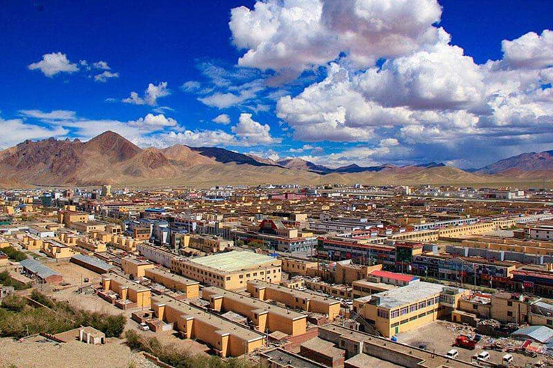
Shiquanhe is the administrative centre of Ngari prefecture and the most important logistics base on the whole G219 Ngari highway. It has hotels, restaurants, hospitals, gas stations and supermarkets. Most travellers use Shiquanhe as a rest stop to refill supplies, recharge and recover from high altitude before exploring the deeper Ngari attractions.
Zanda Earth Forest & Guge Kingdom Ruins
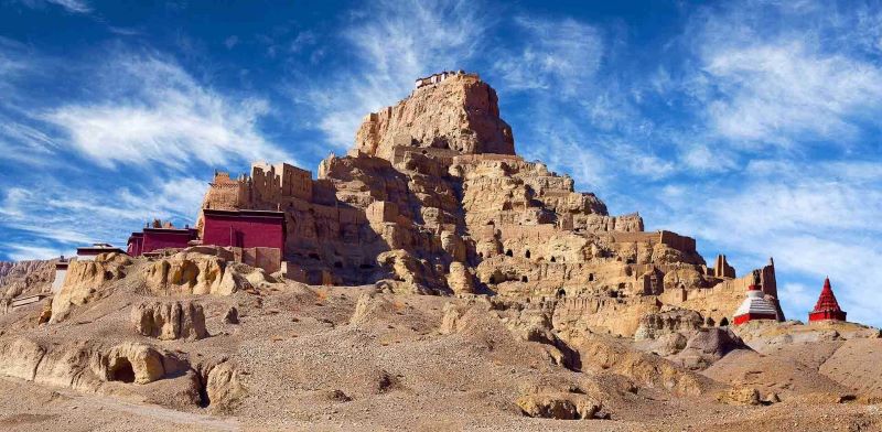
Zanda Earth Forest is a stunning geological wonder. Millions of years of river cutting and wind erosion have sculpted countless earthen peaks, valleys and castles across the basin. The golden-brown landforms glow dramatically at sunrise and sunset. Within Zanda basin lies the ancient Guge Kingdom Ruins, a mysterious abandoned medieval kingdom perched on a hilltop. Frescoes, caves and ancient temples here tell the lost history of western Tibet travel.
Mount Kailash and Lake Manasarovar
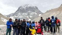
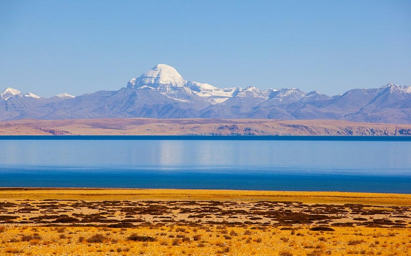
Mount Kailash is the sacred holy mountain for four major religions. Its perfect pyramid-shaped peak stands above the Ngari plateau. Nearby Lake Manasarovar is regarded as the holiest freshwater lake in Tibet. Many pilgrims and travellers come here to admire the mountain and lake. The 54km Mount Kailash kora trek is a famous pilgrimage route, though trekkers must be fully prepared for extreme altitude.
Highland Lakes and Wildlife
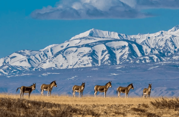
The G219 Ngari route is famous for “one lake after another”, or “Yi Cuo Zai Cuo”. You will pass dozens of lesser-known but breathtaking lakes such as Longmu Tso and Sumxi Tso. Keep your eyes open for plateau wildlife: Tibetan wild ass, Tibetan antelope, wild yaks and black-necked cranes. Please keep a safe distance and never chase or disturb wild animals.
Travel Permits for G219 Ngari Route
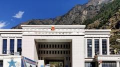
Foreign travellers must prepare two key documents well in advance for the G219 Ngari trip: Tibet Travel Permit and Border Pass. Ngari is a border region, so the border permit is mandatory. All paperwork must be arranged through a licensed local travel agency. Individual travellers cannot apply directly.

Documents for foreigners entering Tibet
You need to submit passport copies and travel itinerary at least 15–30 days before departure. Always carry your original passport and permits. Police and border checkpoints are frequent along G219. You will need to show documents multiple times. Missing any permit will stop your journey immediately. This rule applies for anyone planning a Tibet overland tour through this remote western region.
Altitude Sickness Prevention
Altitude risk is the biggest challenge on the G219 Ngari route. Many mountain passes exceed 5000 meters and most overnight towns sit above 4200m.
1. Avoid flying directly into Ngari. The best way is gradual altitude gain, travelling from lower elevation upward.
2. Stay hydrated, drink plenty of water. Do not drink alcohol, smoke or overexert yourself in the first 2–3 days.
3. Do not take hot showers on your first night at high altitude, as it may trigger altitude sickness.
4. Prepare basic medicine for headache, and portable oxygen canisters. If you develop severe symptoms including persistent vomiting, chest pain and breathing difficulty, descend to lower altitude immediately and seek medical help.
5. Keep warm. The plateau temperature drops sharply after sunset, even in summer. Cold can worsen altitude reaction.
Driving & Vehicle Tips for G219 Ngari
The G219 Ngari section is mostly paved asphalt road now, but weather and occasional road maintenance can create temporary rough patches. A 4WD SUV is strongly recommended for self-drive travellers.
– Fuel stations are sparse. Refill your tank fully every time you pass a gas station, especially between Dahongliutan and Shiquanhe.
– Carry spare tyres, tyre repair tools, jumper cables, engine antifreeze and enough drinking water and food. Some no-man’s-land stretches have no shops or emergency services.
– Drive slowly. Strong crosswinds are common on mountain passes. Watch for wandering livestock and wild animals on the road at dawn and dusk.
– Night driving is not recommended. There are limited street lights and sudden temperature drops may cause icy road surfaces.
Accommodation & Food
Accommodation choices on G219 Ngari are limited. Most towns offer simple hotels. Shiquanhe, Zanda and Baga have better options, including oxygen-supplied rooms for altitude relief. Remote villages only have basic guesthouses. Book accommodation in advance during peak travel season from July to August.
Local food mainly includes Tibetan noodles, butter tea, tsampa, yak meat and Sichuan-style dishes. Bring some snacks, energy bars and dried fruits in case you cannot find restaurants in remote areas.
Best Travel Time & What to Pack
The best travel window for G219 Ngari route is June to September. Summer brings milder weather, melted snow on passes and open road access. G219 Ngari winter travel is not recommended for most tourists, as heavy snow often closes high mountain passes and temperatures can plunge far below zero.
Packing checklist: warm down jacket, windproof waterproof outerwear, thermal underwear, UV protection sunglasses, high SPF sunscreen, lip balm, hat and gloves. The plateau UV radiation is extremely strong. Also bring power banks, satellite communicator or offline GPS maps, as mobile signal is lost in many no-man’s-land segments.
Frequently Asked Questions
Q1: Can I drive G219 Ngari by myself?
A1: Self-drive is possible with a 4WD vehicle, but travellers must have high-altitude driving experience. Many visitors prefer hiring a local driver-guide who knows the road conditions, checkpoints and emergency stops.
Q2: How long is G219 Ngari route?
A2: A minimum of 10 days is recommended for the classic Ngari sightseeing loop. If you only cross from Xinjiang to Shiquanhe without visiting Mount Kailash and Zanda, you can finish in 4–5 days, but you will miss the core Ngari highlights.
Q3: Is G219 Ngari safe for travellers?
A3: The highway itself is safe when you follow altitude rules and driving guidelines. The main risks are altitude sickness, sudden weather changes and long distances between emergency support. Travel with a planned itinerary and reliable local support.
Q4: What wildlife can I see on G219 Ngari?
A4: Tibetan antelope, wild yak, Tibetan wild ass, black-necked cranes and foxes are commonly spotted. Please observe wildlife from far away and never get close.
Final Words
The Xinjiang Tibet Highway G219 Ngari Route is not just a road trip. It is a journey into one of the last great wild places on our planet. When you travel along G219 Ngari, every mountain pass, every blue lake and every quiet plateau valley invites you to slow down and feel the grandeur of the Tibetan highland. Proper preparation for permits, altitude, fuel and accommodation will make your trip smooth and memorable. Respect local Tibetan culture, protect the fragile plateau environment, take only photos and leave nothing behind.
If you want a tailor-made G219 Ngari private tour, including permit handling, vehicle rental, driver service and pre-booked accommodation, contact our travel team for a custom Ngari itinerary.