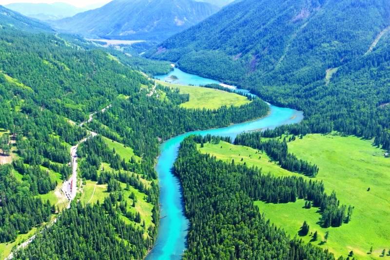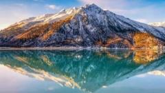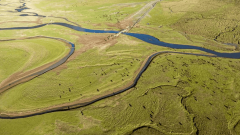

In the northern expanse of the Qinghai-Tibet Plateau lies a vast, unspoiled realm blessed by the heavens. Here, the azure sky feels within arm’s reach, snow-capped peaks cradle emerald lakes, and Tibetan antelopes and wild asses roam freely across endless plains—this is the mesmerizing Northern Tibet Grassland (Changtang Plateau).
As one of Tibet’s most pristine and majestic wilderness zones, Changtang embodies an unmatched high-altitude splendor. This comprehensive guide details the location, transport routes, must-see attractions, and essential tips for embarking on a life-changing journey across Northern Tibet in 2027.
Key Takeaways
-
Geographic Location: The Northern Tibet Grassland primarily refers to the vast Changtang Plateau in northern Tibet (mainly encompassing Nagqu City and northern Ngari Prefecture), sitting at an average elevation above 4,500 meters. It is China’s largest and wild-most high-altitude grassland ecosystem.
-
How to Get There: Travelers can take the Qinghai-Tibet Railway to Nagqu/Damxung Station, fly into Lhasa Gonggar Airport (or Nagqu Dagring Airport if available) followed by a 4WD vehicle rental, or drive via National Highway G109 (Qinghai-Tibet Highway) or G317 (Northern Sichuan-Tibet Highway).
-
Must-See Highlights: Iconic sights include the heavenly Namtso Lake backed by the Nyenchen Tanglha Mountains, the spectacular geometry of Sapu Sacred Mountain, Selin Tso (Tibet’s largest lake), the dual-water Pangong Tso, and the thriving wildlife of the Changtang National Nature Reserve.
-
Travel Recommendation: Due to high altitudes and extreme weather variability, a 5-to-7-day private 4WD or self-drive tour is recommended, along with thorough cold-weather gear and high-altitude preparation.
Where Is the Northern Tibet Grassland? Location & Geography
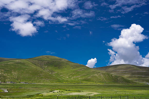
In Tibetan, the Northern Tibet Grassland is known as “Changtang,” which translates to “Northern High Plains.” In a broad sense, it encompasses the entire Nagqu City and the northern and eastern regions of Ngari Prefecture, spanning over 1,200 kilometers from east to west and 700 kilometers from north to south.
Average Altitude: The entire region sits at an impressive average altitude of 4,500 to over 5,000 meters.
Terrain & Ecosystem: Bordered by the Kunlun Mountains and Hoh Xil to the north, and the Nyenchen Tanglha and Gangdise ranges to the south, Changtang boasts China’s largest concentration of high-altitude lakes and serves as a sanctuary for hundreds of rare plateau wildlife species.
How to Get to Northern Tibet: 2027 Transportation Guide
Given the vastness of Changtang, Lhasa or Nagqu City usually serve as the primary transit hubs for entering the region.
1. By Train (Most Scenic Route)
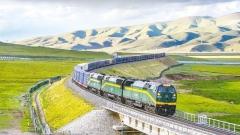
Taking the world-famous Qinghai-Tibet Railway is the most classic and altitude-acclimatizing way to reach Northern Tibet.
Key Stations: Disembark at Damxung Station (near Namtso Lake) or Nagqu Station (the central hub of Northern Tibet).
Highlights: The train glides across the Changtang Plateau, offering panoramic window views of endless plains, snow peaks, and grazing wildlife.
2. By Flight + Overland Transfer
Fly into Lhasa: Fly to Lhasa Gonggar International Airport, spend 1–2 days acclimatizing in Lhasa, and then hire a 4WD vehicle to drive north into Changtang.
Fly into Nagqu/Qamdo: Seasonal regional flights connect to local airports; however, landing directly above 4,000 meters requires strict caution regarding acute mountain sickness (AMS).
3. By 4WD Overland Driving
Renting or chartering a 4WD (Four-Wheel Drive) vehicle is the best way to venture deep into the grassland.
G109 Qinghai-Tibet Highway: Heading north from Lhasa through Damxung to Nagqu, this well-paved route is ideal for first-time visitors.
G317 Northern Highway: Traverses eastern Nagqu, giving access to hidden gems like Sapu Mountain and the Three-Color Lakes of Biru.
Northern Tibet Circuit (Changtang Loop): Best suited for adventure travelers, venturing from Nagqu deep into Baingoin, Nyima, and Gerze to loop around Tibet’s great lake clusters.
Unmissable Highlights of Northern Tibet
Far more than a simple expanse of grass, the Northern Tibet Grassland is a dramatic tapestry of glaciers, holy lakes, sacred mountains, and rare wildlife.
Namtso Lake & Nyenchen Tanglha Mountains
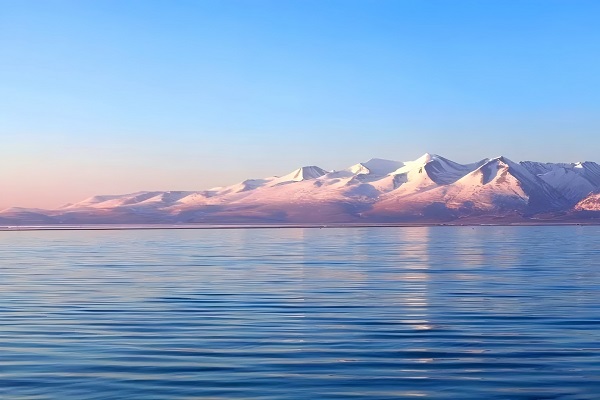
Straddling Damxung and Baingoin counties, Namtso (meaning “Heavenly Lake”) is Tibet’s second-largest lake. Sitting at 4,718 meters, its deep blue waters gaze across at the towering snow-capped peak of Mount Nyenchen Tanglha. The sacred rock formations of the Tashi Peninsula offer an unforgettable glimpse into divine natural beauty.
Sapu Sacred Mountain (Mount Sapu)
Located in Biru County, Sapu Mountain has emerged as a crown jewel of Northern Tibet. It features extraordinarily rare, near-perfect geometric equilateral triangle peaks, at the foot of which lie glacial lakes and surreal, crystal-blue ice formations that resemble a landscape from another planet.
Selin Tso (Serling Tso)
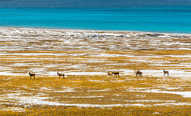
Selin Tso is currently the largest lake in Tibet (having expanded beyond Namtso). Under varying sunlight, its waters shift through rich layers of deep navy, turquoise, and jade. Herds of Tibetan wild asses and antelopes frequently graze along its shores, showcasing the raw vitality of the plateau.
Pangong Tso
Located at the western edge of Changtang in Rutog County, Pangong Tso is a long, narrow alpine lake famous for its dual nature: the eastern portion within China consists of fresh water rich in fish and vegetation, while the western portion is saline and barren, forming a striking natural phenomenon.
Changtang National Nature Reserve
The boundless plains are home to the “Three Treasures of Changtang”—the Tibetan antelope, wild yak, and Tibetan wild ass (Kiang), alongside snow leopards and black-necked cranes. Along the highways, you can frequently witness wild animals running across the golden grasslands under the setting sun.
Essential Travel Advice for 2027
Altitude Sickness Prevention: Elevations remain strictly above 4,500 meters throughout Changtang, with long driving distances between spots. Ensure adequate acclimatization in Lhasa or lower altitudes beforehand, and carry portable oxygen canisters and AMS medications (e.g., Ibuprofen, Diamox).
Cold & Sun Protection: Even in mid-summer (July–August), nighttime temperatures can drop near 0°C with fierce winds. Thermal layers, heavy down jackets, windproof outer shells, beanies, and high-SPF sunblock are essential.
Road Conditions & Off-Grid Navigation: Mobile signals can be weak in the remote interior of Changtang. Keep vehicle fuel tanks full at all times, and carry offline maps along with satellite communication tools.
Protect the Fragile Ecosystem: The high-altitude tundra ecosystem takes decades to recover from damage. Vehicles must strictly stay on designated roads and avoid driving over wild grasslands. Always carry out all trash.
In 2027, the Northern Tibet Grassland remains as pure, wild, and awe-inspiring as ever. Standing beside a turquoise sacred lake, gazing up at glacial peaks, and hearing the wind echo across the endless plains is an unforgettable baptism for the soul. Pack your gear and set off on an epic journey into Tibet’s great wilderness!