
The Himalayan Mountains form one of the most dramatic geographic features on Earth, stretching roughly 2,400 kilometers across South Asia and separating the Indian subcontinent from the Tibetan Plateau. A map of the Himalayas reveals far more than a chain of enormous peaks: it shows a complex landscape of glaciers, valleys, rivers, ancient trade routes, sacred sites, and communities spread across several countries. For international travelers, understanding the Himalayan map is particularly useful because it explains how destinations such as Nepal, Tibet, Bhutan, northern India, and Pakistan connect to one of the world’s greatest mountain systems.
Key Points
- The Himalayas stretch approximately 2,400 km (1,500 miles) across South Asia.
- The range spans China (Tibet), Nepal, India, Bhutan, and Pakistan.
- Mount Everest, at about 8,848.86 m, is the world’s highest mountain and lies on the Nepal–China border.
- The Himalayas are commonly divided into the Greater Himalayas, Lesser Himalayas, and Outer Himalayas.
- Major Asian rivers, including the Ganges, Indus, and Brahmaputra, are closely connected to the Himalayan and Tibetan highland region.
- Major Himalayan destinations include Kathmandu, Lhasa, Everest Base Camp, Leh, Thimphu, and Skardu.
- The region is important for mountaineering, trekking, religion, biodiversity, agriculture, and freshwater resources.
Where Are The Himalayan Mountains On A Map?
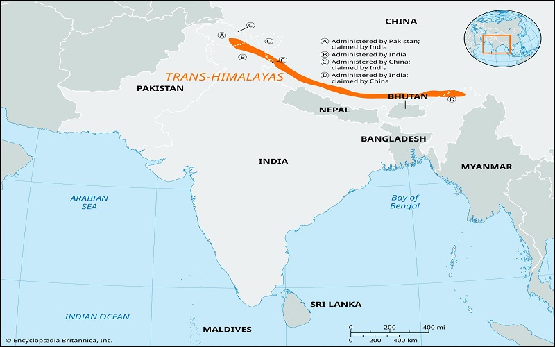
On a world map, the Himalayas occupy a long arc across southern Asia. They form a natural boundary between the high Tibetan Plateau to the north and the plains and valleys of the Indian subcontinent to the south.
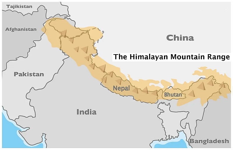
The range generally extends from the vicinity of Pakistan and northern India in the west toward Nepal and Bhutan in the east, with the Himalayan system continuing into areas associated with China’s Tibet Autonomous Region. Because the mountains cross several modern political boundaries, a Himalayan Mountains map is often best understood alongside a map of South Asia.
The Himalayas are not a single narrow wall of mountains. They consist of multiple parallel ranges, high valleys, plateaus, glaciers, river systems, and foothills. Their geography changes considerably from west to east, which is why the landscapes around Everest can look very different from those around Kashmir, Ladakh, Bhutan, or eastern Nepal.
The northern side of the Himalayan system rises toward the Tibetan Plateau, one of the highest large-scale elevated regions on Earth. To the south, the mountains descend through increasingly lower ranges before reaching the plains of India and Pakistan.
This geographic arrangement has shaped climate, transportation, agriculture, religion, and human settlement for thousands of years.
Himalayan Mountains on World Map
Which Countries Are Part Of The Himalayas?
A Himalayan map usually shows the mountain system extending across China, Nepal, India, Bhutan, and Pakistan. However, the exact geographic definition of the Himalayas can vary depending on whether a map refers to the main Himalayan range or the broader Himalayan mountain system.
China And Tibet
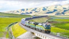
The northern side of the Himalayas borders the Tibetan Plateau. The Tibet Autonomous Region occupies a huge high-altitude area north of the main Himalayan crest.
For travelers, Tibet is particularly important because the region provides access to some of the most spectacular northern landscapes of the Himalayas, including the Tibetan side of Mount Everest.
The Tibetan side also provides access to major Himalayan destinations such as Everest Base Camp, while western Tibet connects the Himalayan landscape with sacred destinations including Mount Kailash.
Nepal
Nepal occupies a central position in the Himalayan mountain system. Some of the world’s best-known trekking and climbing routes are located here, including routes toward Everest Base Camp and the Annapurna region.
Nepal is also home to Kathmandu, one of the principal gateways for international travelers exploring the Himalayas.
India
The Himalayas extend across several northern Indian states and territories, including areas around Ladakh, Himachal Pradesh, Uttarakhand, Sikkim, and Arunachal Pradesh.
The Indian Himalayas contain a remarkable mixture of landscapes, from high-altitude deserts around Ladakh to forested valleys and snow-covered peaks farther east.
Bhutan
Bhutan occupies a mountainous position between India and Tibet. Its northern landscape rises into the high Himalayas, while its valleys contain forests, monasteries, villages, and important cultural sites.
Thimphu, Bhutan’s capital, is one of the best-known urban centers located within the Himalayan region.
Pakistan
The western Himalayan region extends into northern Pakistan, where it meets other major mountain systems, particularly the Karakoram. The town of Skardu is a major gateway for expeditions toward some of the world’s highest mountains, including K2.
It is important to distinguish the Himalayas from the Karakoram even though the two systems are geographically close and often appear together on broader mountain maps.
Countries Surrounding the Himalayas
Himalayan Mountains Map And Major Cities
The Himalayas are not an empty wilderness. A map shows a network of cities and towns that serve as cultural centers, transportation gateways, and bases for trekking and exploration.
Kathmandu
Kathmandu is one of the most important international gateways to the Himalayas. The city combines historic temples, Buddhist sites, traditional neighborhoods, and modern travel infrastructure.
For visitors heading toward the Nepal side of Everest, Kathmandu is often the first major stop.
Lhasa
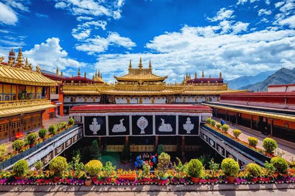
Lhasa is the cultural and administrative center of Tibet and an important gateway to the northern side of the Himalayas.
Its location on the Tibetan Plateau makes it particularly useful for travelers who want to combine cultural exploration with high-altitude journeys toward Shigatse, Everest, or western Tibet.
Leh
Leh, in India’s Ladakh region, is another major high-altitude destination. Its location amid dramatic mountains and valleys makes it an important center for Himalayan tourism and Buddhist culture.
Thimphu
Bhutan’s capital, Thimphu, sits within a mountainous valley and provides access to the distinctive Himalayan culture and landscapes of Bhutan.
Skardu
Skardu is a major gateway to northern Pakistan’s high mountains and is particularly associated with expeditions into the Karakoram.
Understanding The Three Main Himalayan Zones
A physical map makes the structure of the Himalayas easier to understand. The mountain system is often described through three broad parallel zones: the Greater Himalayas, Lesser Himalayas, and Outer Himalayas.
Greater Himalayas
The Greater Himalayas, sometimes called the High Himalayas, form the highest and most dramatic part of the mountain system.
This zone contains many of the world’s highest peaks, including Mount Everest and numerous other mountains exceeding 8,000 meters.
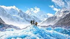
The landscape is dominated by glaciers, permanent snowfields, steep rock walls, and high mountain passes. Human settlement is relatively limited at the highest elevations because of the extreme environment.
For mountaineers, this is the section of the Himalayas that represents the ultimate high-altitude challenge.
Lesser Himalayas
South of the highest ranges lies the Lesser Himalayas. Although elevations are lower, the terrain remains highly mountainous.
This region contains deep valleys, forested slopes, agricultural terraces, towns, monasteries, and hill stations. Many communities live in this transitional zone because conditions are generally more suitable for permanent settlement than in the high mountains.
Several well-known Himalayan cultural destinations are located within or near this broader zone.
Outer Himalayas
The Outer Himalayas, also known as the Siwalik Hills, form the southernmost foothills.
Compared with the high mountain ranges farther north, these hills are lower and warmer. They gradually transition into the plains of northern India and Pakistan.
A map showing all three zones demonstrates how dramatically elevation changes across a relatively short north-south distance.
The Highest Peaks On A Himalayan Map
Mount Everest naturally dominates most maps of the Himalayas, but it is only one part of an extraordinary collection of high mountains.
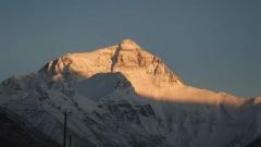
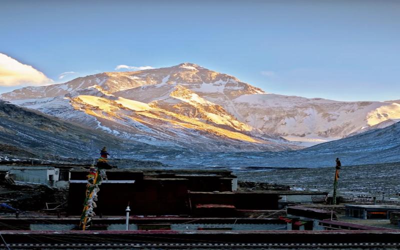
Mount Everest rises to approximately 8,848.86 meters (29,031.7 feet) and sits on the border between Nepal and China’s Tibet Autonomous Region.
Other famous Himalayan peaks include Kangchenjunga, Lhotse, Makalu, Cho Oyu, Dhaulagiri, and Manaslu.
The concentration of extremely high peaks is one reason the Himalayas are often described as the world’s greatest mountain range.
A detailed mountain map also reveals that some famous peaks associated with the broader Himalayan region are actually located in neighboring mountain systems. K2, for example, belongs to the Karakoram rather than the Himalayas proper.
For travelers, this distinction is useful because destinations marketed broadly as “Himalayan” may actually belong to different geographic ranges.
Mount Everest
Major Rivers And The Himalayan Map
The Himalayas are closely connected to some of Asia’s most important river systems.
The mountains and the wider Tibetan highland region act as enormous water reservoirs. Snow, glaciers, wetlands, and seasonal rainfall feed river systems that eventually flow across large parts of Asia.
The Ganges
The Ganges basin supports enormous populations across northern India and Bangladesh. Himalayan glaciers and mountain catchments contribute to the river system, making the high mountains important to communities far beyond the immediate mountain valleys.
The Indus
The Indus River system is particularly important to Pakistan and northern India. Its upper reaches are closely associated with the Tibetan Plateau and the western Himalayan region.
The Brahmaputra
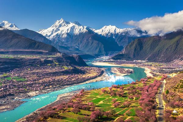
The Brahmaputra begins on the Tibetan Plateau, where it is known as the Yarlung Tsangpo. It travels eastward across Tibet before turning south toward India and Bangladesh.
The dramatic geography around the Yarlung Tsangpo is among the most spectacular river landscapes in the Himalayan region.
These rivers demonstrate why the Himalayan map matters far beyond mountaineering. The mountains influence water availability, agriculture, ecosystems, and human settlement across a huge part of Asia.
Himalayan Mountains Map For Travelers
For international visitors, a geographic map can be much more useful than simply identifying where Mount Everest is.
The Himalayas cover such a vast area that different destinations offer completely different travel experiences.
Someone interested in trekking might choose Nepal. Someone looking for Tibetan Buddhist culture and high-altitude landscapes might consider Tibet. Travelers interested in remote mountain valleys might explore Ladakh or Bhutan, while serious mountaineers may travel toward Nepal or northern Pakistan.
The map also helps explain travel distances.
For example, Kathmandu and Lhasa may look relatively close on a map, but the Himalayan terrain between them creates a very different journey from traveling between two cities on a flat plain. Mountain passes, border crossings, altitude changes, weather, and road conditions can all affect travel time.
This is why planning a Himalayan journey based solely on straight-line distance can be misleading.
Himalayan Trekking And Mountaineering Routes
The Himalayas are famous for some of the world’s most iconic trekking and mountaineering routes.
On the Nepal side, the Everest Base Camp trek is among the most recognizable. Trekkers travel through the Khumbu region, passing Sherpa villages, monasteries, suspension bridges, and increasingly high mountain terrain.
The Annapurna region provides another major trekking destination, with routes through valleys, forests, high passes, and traditional villages.
On the Tibetan side, travelers can visit Everest Base Camp from the north, where the mountain appears dramatically above the Tibetan Plateau.
Western Tibet offers an entirely different experience through the Mount Kailash Kora, a pilgrimage route around one of the most sacred mountains in Asia.
These routes illustrate an important point: there is no single “Himalayan experience.” Geography, culture, altitude, and landscape can change dramatically from one part of the range to another.
Cultural And Religious Importance Of The Himalayas
A Himalayan Mountains map also tells a cultural story.
For centuries, the mountains have been sacred to several religious traditions, particularly Hinduism and Buddhism.
Mountains, lakes, rivers, caves, monasteries, and pilgrimage routes have all acquired spiritual significance.
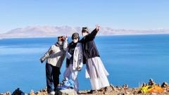
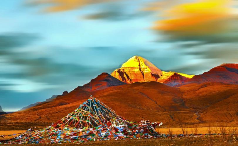
One of the most famous examples is Mount Kailash in western Tibet. Revered in Tibetan Buddhism, Hinduism, Jainism, and the Bon tradition, the mountain is considered sacred and is traditionally approached through pilgrimage rather than climbing.
Other important sites across the Himalayan region include monasteries in Tibet, Buddhist communities in Nepal and Bhutan, and Hindu pilgrimage destinations in the Indian Himalayas.
The geography itself has helped preserve these traditions. For centuries, difficult mountain terrain limited access and allowed distinctive languages, customs, architecture, and religious practices to develop in isolated valleys.
Historical Trade Routes Across The Himalayas
Before modern highways and airports, Himalayan passes were important transportation corridors.
Merchants, pilgrims, monks, and explorers traveled between the Tibetan Plateau, South Asia, and Central Asia through mountain passes and valleys.
These routes were difficult and dangerous, but they allowed goods, ideas, religious beliefs, languages, and cultural practices to move between regions.
The Himalayan mountains therefore acted both as a barrier and as a bridge.
Modern roads and transportation networks have replaced many traditional trade routes, but travelers can still see evidence of these historic connections in monasteries, old towns, caravan routes, and border regions.
The Himalayas And Tourism
Today, tourism is one of the most visible connections between the Himalayas and the outside world.
Trekking, mountaineering, cultural tours, photography, wildlife observation, spiritual journeys, and scenic travel all attract international visitors.
Nepal’s Everest region is particularly famous for trekking and climbing. Tibet offers a combination of high-altitude landscapes, Buddhist culture, major monasteries, and overland journeys toward Everest and Mount Kailash.
The Himalayan tourism experience also varies according to elevation. A visitor can travel from subtropical foothills through temperate forests and alpine valleys before reaching landscapes of permanent snow and ice.
This enormous environmental range is one of the reasons Himalayan travel is so visually diverse.
Wildlife And Biodiversity Of The Himalayas
Despite the harsh environment, the Himalayas support remarkable biodiversity.
Different elevations create different ecosystems, ranging from subtropical forests in the foothills to alpine meadows and high-altitude deserts.
Among the best-known animals associated with the Himalayan region are snow leopards, red pandas, Himalayan tahr, Himalayan monals, wild yaks, musk deer, and numerous species of mountain birds.
Protected areas have become essential to maintaining these habitats.
Nepal’s Sagarmatha National Park, India’s Great Himalayan National Park, and Bhutan’s Jigme Dorji National Park are examples of protected landscapes that combine conservation with local communities and tourism.
For wildlife enthusiasts, understanding the geographic zones on a Himalayan map can help explain why certain animals occur at particular elevations and in particular regions.
Why The Himalayan Map Matters For International Travelers
A Himalayan Mountains map is more than a geographical reference.
It helps travelers understand why a trip to Everest, Tibet, Bhutan, Ladakh, or northern Pakistan can involve very different landscapes, climates, cultures, and travel conditions.
It also puts famous destinations into perspective. Everest is only one peak within a massive mountain system. The Himalayas connect glaciers and rivers with forests and plains, while ancient pilgrimage routes connect remote mountain communities with some of Asia’s major cultural traditions.
For travelers planning a trip to Tibet, the map is particularly useful for understanding the relationship between Lhasa, Shigatse, Everest, western Tibet, Mount Kailash, and the Himalayan borderlands.
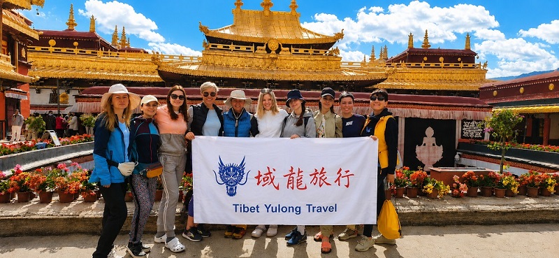
If your journey focuses on Tibet, working with a local operator can also make complicated high-altitude logistics easier. Tibet Yulong Travel specializes in Tibet tours for international travelers, including routes connecting Lhasa with Everest, western Tibet, and Mount Kailash. A locally organized journey can help travelers better understand distances, altitude acclimatization, transportation, permits, and regional conditions before setting out.
Frequently Asked Questions About The Himalayan Mountains Map
How Long Are The Himalayan Mountains?
The Himalayas extend for approximately 2,400 kilometers (1,500 miles) across South Asia, although the exact measurement can vary depending on how the broader mountain system is defined.
Which Countries Do The Himalayas Cross?
The Himalayan mountain system is associated with China, Nepal, India, Bhutan, and Pakistan. The exact boundaries of the Himalayan range can vary between geographic classifications.
Where Is Mount Everest On A Himalayan Map?
Mount Everest is located on the Nepal–China border, with the southern approach in Nepal and the northern approach in China’s Tibet Autonomous Region.
Why Are The Himalayas Important?
The Himalayas are important because they influence water resources, climate, biodiversity, agriculture, culture, religion, and tourism across a large part of Asia.
What Is The Highest Mountain In The Himalayas?
Mount Everest is the highest mountain in the Himalayas and on Earth, with an officially recognized elevation of approximately 8,848.86 meters (29,031.7 feet).
What Wildlife Lives In The Himalayas?
The region supports animals including snow leopards, red pandas, Himalayan tahr, Himalayan monals, wild yaks, musk deer, and many other species.
When Is The Best Time To Visit The Himalayas?
There is no single best season for the entire Himalayan range. Conditions vary considerably by country, altitude, and destination. In general, spring and autumn are popular travel periods for many trekking and cultural routes, while specific high-altitude destinations require more careful seasonal planning.