
In Tibet, there is a famous saying: “Without visiting Ngari, you haven’t truly experienced Tibet.” Situated in far western Tibet at an average elevation exceeding 4,500 meters (14,760 feet), Ngari is celebrated as the “Roof of the Roof of the World.”
For travelers who dream of witnessing Ngari’s sacred landscapes without facing the extreme survival conditions of the northern wilderness, the Ngari Small Loop (also known as the Southern Circuit) is the undisputed gold standard. This circuit combines world-class natural wonders and ancient history with reliable roads and modern travel amenities.
Key Takeaways
- Classic & Safe Route: The Ngari Small Loop (Southern Circuit) runs primarily along National Highway G219 (Xinjiang-Tibet Highway). It covers Tibet’s most iconic sacred mountains, holy lakes, and ancient civilizations via paved highways with reliable medical and supply stops.
- Key Differences from the Grand Loop: The Small Loop features smooth paved roads, gradual altitude gain, and developed lodging. In contrast, the Grand Loop cuts deep into the Changtang No-Man’s Land, involving extreme elevations (4,800m+), unpaved dirt roads, remote alpine lakes, and wild animals.
- Rich Diversity & Modern Amenities: Beyond Mount Kailash and Lake Manasarovar, the Small Loop includes Everest Base Camp, Shishapangma, Kyirong Valley, and Guge murals. Major towns along the circuit offer clean 3- to 4-star hotels and a wide range of hot Sichuan and Tibetan cuisine.
Overview: How Does the Small Loop Differ from the Grand Loop?
Travel itineraries in Ngari are primarily divided into the Small Loop (Southern Circuit) and the Grand Loop (Northern Circuit). They differ significantly in terrain, landscape, and difficulty:
Route Trajectory & Road Conditions
Small Loop (Southern Circuit): Built around National Highway G219, this route is virtually 100% paved asphalt. Starting from Lhasa, it passes through Shigatse and Saga to reach Darchen (at the foot of Mt. Kailash) and Zanda County, with an optional detour to the lush Kyirong Valley.
Grand Loop (Northern Circuit): After reaching Zanda or Shiquanhe, drivers leave the national highway behind and head east directly into the vast Changtang National Nature Reserve, tackling hundreds of kilometers of unpaved dirt, gravel, and riverbed tracks.
Altitude Gain & Safety Risk
Small Loop: Altitude increases gradually from Lhasa (3,650 m) to Shigatse (3,800 m) and Saga (~4,500 m). Towns along the highway have local medical facilities and oxygen supplies, making altitude acclimatization much easier.
Grand Loop: Once inside the Changtang wilderness, elevations stay consistently between 4,700 and 5,000+ meters. Weak cellular coverage and unpredictable weather make it a high-risk route requiring serious off-road vehicles and tough endurance.
Highlights & Scenic Focus
Small Loop: Focuses on iconic sacred peaks, holy lakes, and ancient civilizations—including 8,000-meter Himalayan giants, four religions’ holy mountain, thousand-year-old kingdom murals, and clay canyons.
Grand Loop: Focuses on wilderness exploration and wildlife, featuring dozens of untouched high-altitude lakes (“lake-hopping”) and native animals like Tibetan antelopes, kiangs, and wild yaks.
Top Attractions Along the Ngari Small Loop
The Small Loop connects some of the most extraordinary natural and historical sites in Asia:
Yamdrok Lake & Karola Glacier
Your first major visual highlights after leaving Lhasa. Yamdrok Lake resembles a winding turquoise ribbon nestled among mountains. Nearby, the Karola Glacier hangs dramatically down the mountain slope right beside the highway.
Mount Everest Base Camp & Shishapangma
The Small Loop seamlessly connects to Everest Base Camp (5,200 m), where you can view the world’s highest peak at sunset and visit Rongbuk Monastery. Further west, you will pass Shishapangma (8,027 m)—the only 8,000m peak located entirely within China—and its crystal-clear mirror lake, Pelku Tso.
Mount Kailash (The Center of the World)
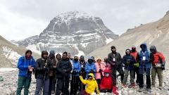
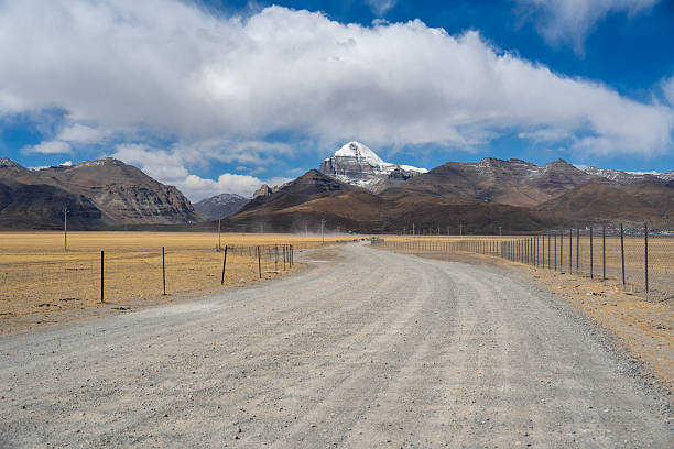
Shaped like a giant pyramid clad in perpetual snow, Mount Kailash is revered by Tibetan Buddhists, Hindus, Jains, and Bonpos as the “Center of the World.” Thousands of pilgrims journey here every year to complete the intense 52-kilometer trekking circuit (Kora) around its base.
Lake Manasarovar & Lake Rakshastal
Lake Manasarovar: One of Tibet’s three great sacred lakes, its deep blue waters are believed to wash away a lifetime of sins.
Lake Rakshastal (“Ghost Lake”): Separated from Manasarovar by a narrow strip of land, this dark, salty lake features turbulent winds and desolate shores, creating a striking contrast between divine peace and eerie solitude.
Zanda Earth Forest & Guge Kingdom Ruins
Zanda Earth Forest: Formed millions of years ago by lakebed erosion, this geological marvel spans hundreds of square kilometers of clay towers that look like ancient alien castles.
Guge Kingdom Ruins: Perched on a steep clay hill within the forest, this 10th-century citadel once ruled western Tibet before mysteriously vanishing in the 17th century. Its surviving red and white chapels house remarkably preserved ancient frescoes.
Kyirong Valley (Optional Detour)
If time permits, you can branch south into Kyirong Valley near the Nepal border. Here, elevation drops to 2,000–2,800 meters, transforming the scenery into lush alpine forests and roaring waterfalls—a refreshing break from the high-altitude desert.
Accommodation & Dining Survival Guide
Infrastructure along the Ngari Small Loop has improved dramatically, making travel far more comfortable than in years past:
Lodging Expectations
Gateway Cities (Shigatse): Offers full modern amenities, ranging from international hotel chains to boutique Tibetan inns with 24-hour hot water, heating, and oxygen facilities.
Major Transit Towns (Saga, Kyirong, Zanda): Feature clean business hotels and comfortable inns equipped with private bathrooms, electric blankets, and heating.
Mount Kailash Hub (Darchen): Darchen offers a variety of standard hotels and local guesthouses. Note: If you undertake the 2-day Kailash Trek, accommodations at mountain waypoints (like Dirapuk Monastery) remain basic multi-bed dorms with shared facilities. Bringing a lightweight sleeping bag is highly recommended.
Dining & Food Supply
Hot Sichuan & Tibetan Meals: Because many eateries are run by Sichuan natives, hot stir-fries, noodle soups, hotpots, and wood-bucket fish are readily available even in remote towns. High-calorie hot food helps sustain energy in the cold.
Local Tibetan Flavors: In Darchen and Saga, try local Tibetan teahouses for sweet tea, butter tea, tsampa, dried yak meat, and herbal chicken soup. Butter tea is especially helpful for soothing dry throats and altitude discomfort.
Emergency Supplies: Driving stretches between towns often take 6 to 8 hours. Always carry a refillable insulated thermos (for hot water), beef jerky, chocolate, energy bars, and self-heating meal packs in your vehicle.
Practical Travel Advice for the Small Loop
Acclimatize Step-by-Step: Never rush straight to Ngari upon arriving in Tibet. Spend 2 to 3 days acclimatizing in Lhasa (3,650 m) and Shigatse (3,800 m) before ascending to Saga (4,500 m) and Darchen.
Layering & Sun Protection: Temperature swings are dramatic, with night temperatures dropping near freezing even in mid-summer. Pack a down jacket, windproof shell, thermal layers, gloves, and a fleece hat. High-SPF sunscreen, sunglasses, and lip balm are essential against harsh UV rays.
Permit Requirements: Ngari is a sensitive border region. Chinese mainland residents need a valid Frontier Pass (Bianfangzheng). Hong Kong, Macao, Taiwan, and foreign passport holders must travel via an authorized travel agency with a pre-arranged Tibet Travel Permit (TTP) and Military/Border Clearances.