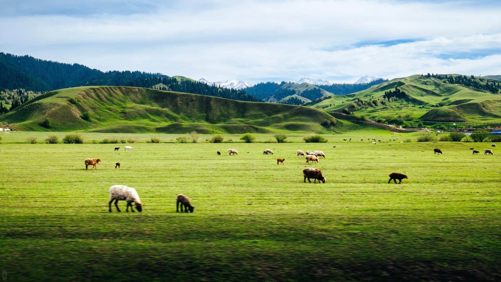

The Kunlun Mountains are one of the great mountain systems of Central Asia, stretching for roughly 2,000 kilometers along the northern edge of the Tibetan Plateau. Unlike the Himalayas, the Kunlun range is often overlooked by international travelers, yet its vast glaciers, high-altitude deserts, snow-covered peaks, and remote valleys reveal some of the most dramatic landscapes in western China. Extending across parts of Xinjiang, Tibet, and Qinghai, the Kunluns are best experienced not as a single destination but as part of an overland journey through the Tibetan Plateau. For travelers seeking remote scenery, geological wonders, and a deeper understanding of Tibet and western China, the Kunlun Mountains offer an extraordinary alternative to the better-known Himalayan routes.
Key Points
- The Kunlun Mountains stretch for about 2,000 km from the Pamirs in the west toward central Qinghai in the east.
- The range extends across Xinjiang, Tibet, and Qinghai, rather than belonging to a single administrative region.
- Kongur Tagh is among the highest peaks associated with the broader western Kunlun system, while many other peaks rise above 6,000 meters.
- The Kunluns are geographically distinct from the Himalayas, lying farther north along the Tibetan Plateau.
- The mountains are extremely dry, remote, and high, with desert, alpine steppe, glaciers, salt lakes, and vast plateaus.
- Foreign visitors generally experience the Kunluns through organized Tibet, Xinjiang-Tibet, or Qinghai-Tibet journeys.
- The Qinghai-Tibet Railway, G109, and G219 provide some of the most practical ways to see the range.
Where Are The Kunlun Mountains?
The Kunlun Mountains form one of the major mountain systems of southern Central Asia. They extend for approximately 2,000 kilometers from the Pamir region in the west toward the Kunlun Pass and neighboring mountain systems of Qinghai in the east. In different sections, the range reaches across or borders areas associated with Xinjiang, the Tibet Autonomous Region, and Qinghai Province.
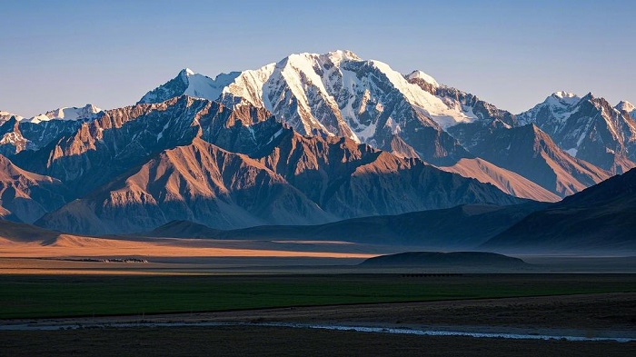
Geographically, the Kunluns form an important natural barrier along the northern side of the Tibetan Plateau. To their north lie vast basins and deserts, including the Tarim Basin and the Taklamakan Desert, while the Tibetan Plateau rises to the south. This dramatic contrast is one reason the Kunlun Mountains have such a powerful visual character: from the northern deserts, they appear as a huge wall of snow and rock separating the lowlands from the high plateau.
The range is not a single continuous ridge. Instead, it consists of multiple parallel ranges, valleys, basins, and subsidiary mountain systems. In the western Kunluns, some of the most impressive peaks are found around the Muztagata and Kongur areas, while farther east the mountains gradually connect with the ranges surrounding the Qaidam Basin and northern Tibetan Plateau.
For travelers, this means there is no single town or entrance called the “Kunlun Mountains.” The experience depends on the route you choose.
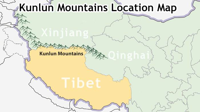
The Kunlun Mountains Location Map
Are The Kunlun Mountains Part Of The Himalayas?
No. The Kunlun Mountains and the Himalayas are separate mountain systems, although both are part of the extraordinary high-altitude landscape of Central and South Asia.
The Himalayas form a great arc farther south, running across countries including Nepal, Bhutan, India, Pakistan, and China. The Kunlun Mountains lie farther north, along the northern edge of the Tibetan Plateau. Between and around these major mountain systems are other important ranges, plateaus, basins, and highland landscapes.
This distinction is particularly useful for travelers planning a Tibet itinerary. A journey through southern Tibet may focus on the Himalayas and peaks such as Mount Everest, while a northern or western route can bring travelers into the landscapes of the Kunlun Mountains.
The two systems also have different visual identities. The Himalayas are famous for enormous glaciated peaks rising dramatically above valleys, while the Kunluns are closely associated with immense high-altitude deserts, broad plateaus, rugged ridges, glaciers, and extraordinarily sparse vegetation.
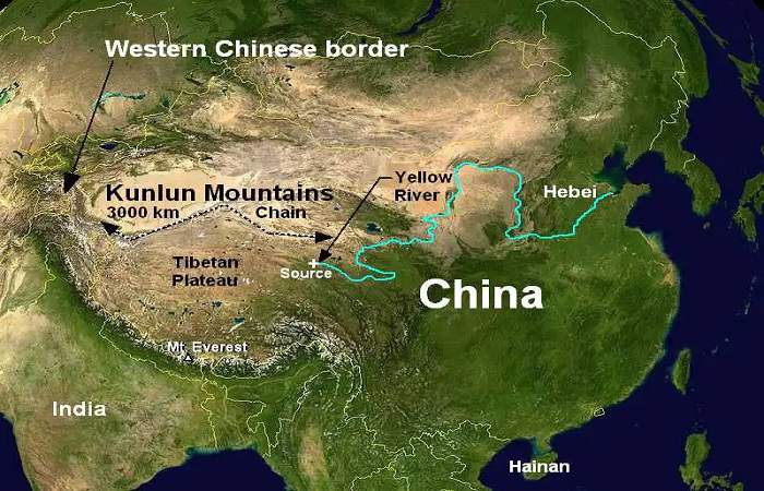
Kunlun Mountains Map
The Physical Geography Of The Kunlun Mountains
Much of the Kunlun range consists of two or three roughly parallel mountain ridges rather than a single crest. This structure becomes particularly apparent in the western part of the system, where the mountains connect with the Pamirs and associated ranges.
Several peaks exceed 6,000 meters, creating an environment where permanent snow and glaciers survive despite the region’s extreme aridity. Among the most famous mountains associated with the western Kunlun and neighboring ranges are Kongur Tagh and Muztagata, which dominate the skyline of the region north of the Tibetan Plateau.
Farther east, the mountain system becomes closely connected with the high Qaidam Basin. High valleys, saline lakes, dry plains, and mountain ridges alternate across the landscape, creating scenery that can feel almost otherworldly.
The surrounding terrain is itself remarkably high. Large sections of the Tibetan Plateau exceed 4,000 meters above sea level, meaning that some Kunlun peaks do not appear as dramatically elevated above their immediate surroundings as Himalayan peaks do above lower valleys. Yet their absolute elevations remain extraordinary.
The landscape is also shaped by wind. Strong winds, freeze-thaw cycles, and extreme temperature differences gradually break down exposed rock, producing large areas of loose gravel, sand, and barren terrain. In some places, dunes appear surprisingly close to snow-covered mountains.
Rivers, Glaciers And High-Altitude Lakes
Despite their dry appearance, the Kunlun Mountains are an important source of water for surrounding regions. Snow and glaciers provide much of the mountain runoff, particularly during the warmer months when melting increases.
Several major river systems originate in or around the highlands associated with the Kunlun and Tibetan Plateau. Water from these mountains ultimately contributes to river systems serving communities and ecosystems across Central and South Asia.
The region is nevertheless far drier than the humid southern Himalayas. Annual precipitation can be extremely low, particularly in the central Kunluns. This combination of high elevation and low precipitation explains why extensive glaciation is surprisingly limited compared with some other high mountain regions.
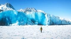
The glaciers that do exist are often steep and confined to the highest peaks. Meltwater may accumulate in closed basins, contributing to saline lakes and salt pans rather than flowing toward the ocean.
This unusual combination of glaciers, desert, and saltwater landscapes makes the Kunlun environment particularly distinctive.
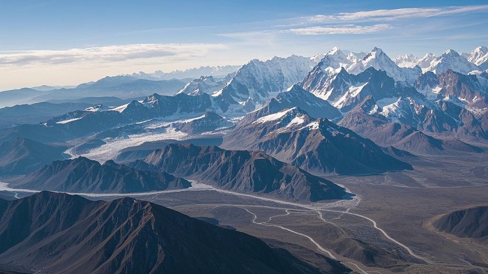
The Kunlun Mountains
Climate Of The Kunlun Mountains
The Kunlun Mountains experience a strongly continental climate. Unlike areas farther south that are heavily influenced by the Indian monsoon, much of the Kunlun system receives very little moisture.
The result is an environment characterized by low precipitation, strong winds, intense sunshine, large temperature differences, and severe winters. At high elevations, winter temperatures can fall far below freezing, while summer conditions may still feel cold because of the altitude.
Daily temperature changes can also be dramatic. Strong solar radiation can warm exposed surfaces during the day, followed by rapid cooling after sunset. Repeated freezing and thawing contributes significantly to rock weathering and erosion.
For travelers, these conditions mean that the Kunlun Mountains should not be treated like a conventional sightseeing destination. Even during warmer months, high-altitude weather can change rapidly, and travelers should be prepared for cold temperatures, strong sunlight, wind, and limited shelter.
Wildlife And Vegetation In The Kunlun Mountains
The extreme climate limits plant growth across much of the Kunlun region. Large areas are essentially alpine desert, while other sections support sparse steppe vegetation.
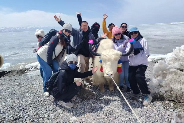
Yet the apparently empty landscape supports wildlife adapted to some of the harshest conditions in Asia. Travelers may encounter or glimpse wild yaks, kiang, Tibetan gazelles, Tibetan antelope, argali sheep, blue sheep, ibex, wolves, and other high-altitude species, depending on the location and season.
The western mountains can support more extensive alpine grasslands, while watercourses may create narrow bands of vegetation. These greener areas are especially important for wildlife and traditional pastoral communities.
The relative lack of roads, towns, and intensive agriculture across many parts of the Kunlun Mountains has also helped preserve large stretches of wilderness. For visitors, one of the most memorable aspects of the region is often not a particular landmark but the sense of enormous open space.
People And Traditional Life Around The Kunluns
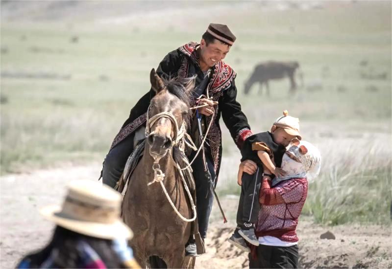
Although the Kunlun Mountains appear almost uninhabited in many photographs, people have adapted to these challenging environments for generations.
Different communities live in and around the wider mountain system, including Tibetan pastoralists, Uyghur communities in northern oasis areas, Mongolian communities, and Tajik and Kyrgyz populations in parts of the western region.
Pastoralism remains particularly important in high-altitude areas. Yaks, sheep, goats, and other livestock are well suited to the cold, dry environment, while agriculture is possible only in relatively favorable locations where irrigation and suitable soils are available.
The contrast between the mountains and the surrounding settlements is striking. In the northern foothills, desert oases support denser communities, while farther south the landscape becomes increasingly dominated by high-altitude grasslands and remote pastoral areas.
For international visitors, traveling through these regions offers an opportunity to see a side of western China that is very different from the major cities and classic tourist destinations.
Are The Kunlun Mountains In Tibet Or Xinjiang?
This is one of the most common questions among international travelers, and the answer is both—and also Qinghai.
The Kunlun Mountains are an extensive mountain system rather than a single administrative destination. Different sections of the range extend through or border different parts of western China.
For travelers, Xinjiang and Tibet are particularly important because several major routes provide access to spectacular views of the western Kunluns. Qinghai is also significant, especially around the Qaidam Basin and the eastern sections of the mountain system.
Therefore, a traveler should choose a route based on the specific landscape they want to experience rather than simply searching for a “Kunlun Mountains tour.”
How To See The Kunlun Mountains From Western Tibet
Western Tibet, especially the Ngari region, offers some of the most dramatic opportunities to experience the Kunlun landscape from the Tibetan Plateau.
The vast open terrain around areas such as Rutog allows travelers to appreciate the relationship between the mountains and the plateau. Snow-covered ridges rise above enormous expanses of barren land, while the absence of dense development creates an exceptional sense of wilderness.
For travelers already planning to visit western Tibet, the Kunlun Mountains can therefore become part of a much larger journey that includes high-altitude lakes, remote valleys, sacred sites, and the extraordinary landscapes of the Tibetan Plateau.
This is particularly attractive for photographers and travelers who prefer remote landscapes to crowded tourist attractions.
Seeing The Kunluns Along The Qinghai-Tibet Railway
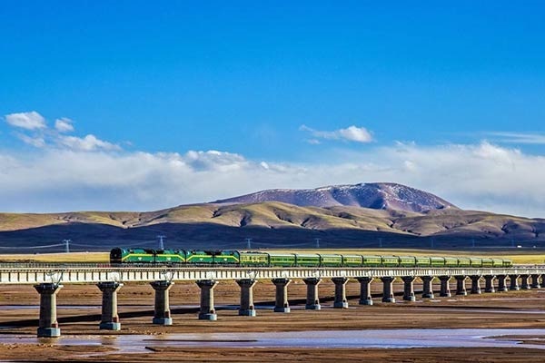
The Qinghai-Tibet Railway provides one of the easiest ways to experience the high-altitude landscape without committing to an extremely long overland expedition.
The section between Golmud and the Kunlun Pass is particularly notable. From the train, travelers can observe snow-covered mountains, rocky slopes, broad valleys, and the vast plateau stretching toward the horizon.
The railway journey also places the Kunlun Mountains within a larger highland experience. Depending on the itinerary, travelers can encounter landscapes associated with Qinghai Lake, Hoh Xil, the Qiangtang region, and other spectacular areas before reaching Lhasa.
For first-time visitors who want to experience the Tibetan Plateau while keeping transportation relatively comfortable, combining train travel with a Tibet itinerary can be an excellent option.
Qinghai–Tibet Train
Exploring The Kunluns Along The Xinjiang-Tibet Highway
For adventurous travelers, the Xinjiang-Tibet Highway, or G219, offers a much more immersive experience.
The route crosses some of the most remote landscapes in western China and provides access to sections of the Kunlun region that are difficult to reach by conventional tourism.
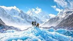
The area between Yecheng and the western Tibetan Plateau is particularly impressive, with enormous mountain walls, barren valleys, glaciers, and high-altitude deserts. Peaks associated with the western mountain systems dominate the horizon, while the road itself becomes part of the adventure.
However, this route requires careful planning. Long distances, limited services, high elevations, rapidly changing weather, and permit requirements mean that it is much better suited to organized overland travel than independent exploration.
Exploring The Kunluns Along The Qinghai-Tibet Highway
The Qinghai-Tibet Highway, or G109, provides another overland option. It connects the Qinghai region with Lhasa and follows a route broadly similar to the Qinghai-Tibet Railway.
The area around Golmud and the Kunlun Pass offers impressive views of the mountain system, while peaks such as Yuzhu Peak and Yuxu Peak add dramatic landmarks to the journey.
Compared with the more remote Xinjiang-Tibet Highway, the Qinghai-Tibet route is generally more straightforward for travelers. It is therefore a practical choice for visitors who want to experience the Kunlun landscape without undertaking one of the most demanding overland journeys in western China.
Can Foreign Travelers Visit The Kunlun Mountains?
Yes, foreign travelers can visit areas of the Kunlun Mountains, but the practical arrangements depend heavily on the specific route and location.
Because much of the range lies in remote, high-altitude, and sometimes sensitive border regions, travelers may encounter permit requirements, restricted areas, limited accommodation, and long distances between settlements.
For trips involving Tibet, foreign visitors generally need to travel through an organized itinerary with the necessary permits and local arrangements. This is particularly important for western Tibet and routes approaching border areas.
The safest and most convenient approach is therefore to work with an experienced local Tibet travel agency that can arrange transportation, permits, accommodation, guides, and route planning according to current regulations.
The Kunlun Mountains
Best Time To Experience The Kunlun Mountains
The best travel period depends on the route and elevation, but warmer months generally provide more manageable conditions for high-altitude travel.
Summer can offer relatively better road conditions and more accessible mountain landscapes, although weather can still change rapidly. Early autumn can also be attractive because of clearer skies and crisp visibility in many parts of the plateau.
Winter is much more demanding. Extreme cold, snow, strong winds, and difficult road conditions can make remote areas substantially harder to reach.
Regardless of season, travelers should remember that altitude is one of the defining characteristics of the Kunlun Mountains. Good acclimatization is essential, particularly on journeys that quickly rise above 4,000 meters.
Practical Tips For International Travelers
A journey through the Kunlun Mountains requires more preparation than a conventional sightseeing trip. Pack warm layers, a windproof outer shell, comfortable trekking shoes, sunglasses, sunscreen, and other high-altitude essentials. Weather conditions can change quickly, so clothing should be adaptable rather than based solely on the season.
Acclimatization is equally important. Travelers should avoid rushing from low elevations directly into the highest parts of the Tibetan Plateau. Building acclimatization days into an itinerary can make the journey considerably more comfortable.
Facilities become increasingly limited in remote areas, so travelers should be prepared for simple accommodation and basic dining. Mobile connectivity and other services may also be inconsistent.
Most importantly, travelers should respect local communities, wildlife, sacred landscapes, and environmental regulations. The remote character of the Kunlun Mountains is part of their appeal, but it also means that visitors have a responsibility to leave as little impact as possible.
Frequently Asked Questions About The Kunlun Mountains
Where are the Kunlun Mountains located?
The Kunlun Mountains extend across a vast area of western China, including parts of Xinjiang, Tibet, and Qinghai. The range runs along the northern side of the Tibetan Plateau and continues eastward toward central Qinghai.
Are the Kunlun Mountains part of the Himalayas?
No. The Kunlun Mountains are a separate mountain system located north of the main Himalayan range. Both belong to the broader high-mountain environment of Central and South Asia, but they have distinct geographical and geological identities.
What is the highest mountain in the Kunlun Mountains?
The western Kunlun system contains several exceptionally high peaks. Kongur Tagh, in the broader western Kunlun/Pamir mountain region, is one of the highest, while numerous other peaks exceed 6,000 meters.
Can tourists visit the Kunlun Mountains?
Yes, but many areas require organized travel, permits, and careful logistical planning. The easiest experiences are generally obtained along established railway and highway routes, while remote western sections require more extensive preparation.
What is the best way to see the Kunlun Mountains?
For most international tourists, the best option depends on their interests. The Qinghai-Tibet Railway offers comfort and convenience, the G109 Qinghai-Tibet route provides an accessible overland experience, while the G219 Xinjiang-Tibet Highway offers a more remote and adventurous journey. Western Tibet’s Ngari region is another excellent choice for travelers already exploring the Tibetan Plateau.
Discover The Remote Grandeur Of The Kunlun Mountains
The Kunlun Mountains are among the least understood yet most spectacular mountain systems for international travelers exploring western China. Stretching thousands of kilometers across an immense high-altitude landscape, they combine snow-covered peaks, glaciers, deserts, grasslands, salt lakes, wildlife, and traditional pastoral cultures in a setting that feels remarkably untouched. Unlike the Himalayas, which are often defined by famous summits such as Everest, the Kunluns are best appreciated as a vast geographical world rather than a single mountain destination.
For travelers who want to go beyond the classic Tibet itinerary, a journey through the Kunlun region can reveal a quieter and more remote side of the Tibetan Plateau. Tibet Yulong Travel can help international visitors plan customized Tibet and western China journeys, including routes through western Tibet, Qinghai-Tibet overland trips, and longer Xinjiang-Tibet adventures, with transportation, permits, accommodation, and local travel arrangements organized according to the itinerary.