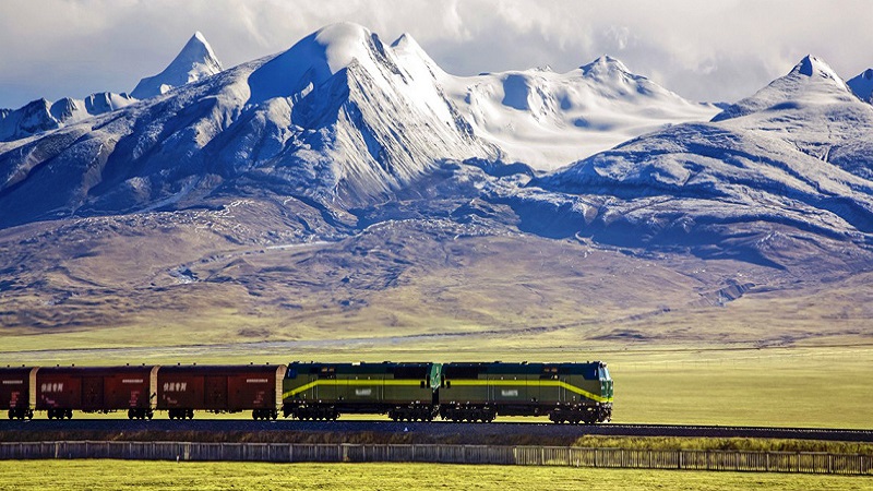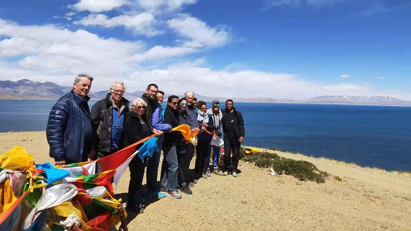

A journey from Purang to Shigatse crosses some of Tibet’s most remote landscapes, linking the far southwest near the borders with Nepal and India to the historic towns and high plateaus of central Tibet. This is not a simple point-to-point drive: road conditions, altitude, permits, weather, and the availability of fuel and accommodation can all shape the route. A sensible plan allows time to acclimatize, treats proposed driving distances as estimates, and keeps room for delays. The itinerary below outlines a cautious overland framework rather than a promise of fixed daily stages; the exact route must be confirmed with a licensed local operator before departure.
- Allow roughly 10–14 days, including acclimatization and contingencies.
- Confirm permits and route access before booking transport.
- Expect long high-altitude drives and basic services outside larger towns.
- Build flexibility around weather, roadworks, and vehicle conditions.
- Arrange the trip through a Tibet-authorized travel agency.
Planning a Purang to Shigatse Backroad Itinerary Tibet
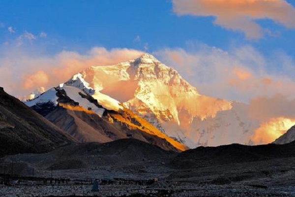
Purang, also known as Burang, lies in Ngari Prefecture in southwestern Tibet. Shigatse, or Xigazê, is a major city in the region south of Lhasa. The route between them is a substantial high-altitude journey, not a short scenic transfer. Depending on the roads approved for use and the stops included, a driver may travel through parts of Ngari and western or southern Tibet before reaching Shigatse. There is no single backroad itinerary that is guaranteed to be open or appropriate for every traveler.
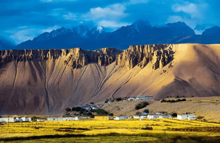
Purang
Treat any map distance as a starting point, not a final schedule. Some sections have sparse services, and daily progress can be affected by road surfaces, security or permit checkpoints, weather, and acclimatization needs. A local operator should verify the permitted route and current conditions shortly before travel. Do not plan to improvise detours toward border areas or restricted sites; access rules can differ by location and may change.
How many days to allow
For a trip that includes cultural and landscape stops, around 10–14 days is a more realistic planning window than trying to cover the distance in a few days. This range can include an arrival and acclimatization period, several nights on the road, time in Shigatse, and a buffer for disruption. Travelers with a tight schedule may need to simplify the route, but should not remove acclimatization days merely to fit a driving plan.
A sample itinerary later in this guide uses flexible stages. It does not assign exact kilometers or guaranteed drive times because the approved roads and actual conditions should determine those details. Ask your operator to provide a day-by-day plan with overnight towns, estimated driving hours, fuel arrangements, and backup options before you confirm the trip.
Permits and travel arrangements
Foreign travelers generally need to arrange Tibet travel through an authorized travel agency and follow the applicable permit and guide requirements. Additional permissions may apply for travel in parts of Ngari or near sensitive border regions. Requirements depend on nationality, destination, route, and current local rules, so verify them directly with your operator well in advance.
Carry the original passport and the documents your agency tells you to bring. Check that the approved itinerary matches the route you intend to take, including overnight stops. A permit for one destination does not automatically authorize travel everywhere nearby. Independent self-driving and unapproved route changes can create serious legal and logistical problems.
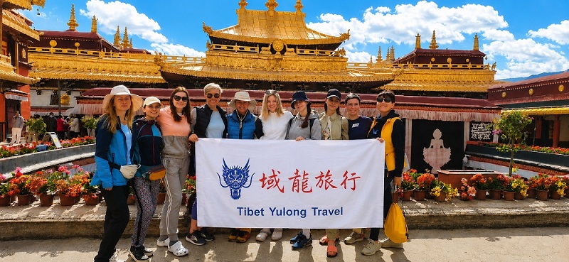
Tibet Yulong Travel can be considered when comparing local trip arrangements, but confirm its current authorization, services, route coverage, written inclusions, cancellation terms, and permit support before paying. Ask who will handle the guide, vehicle, driver, accommodation, and any required travel documents. Get the agreed itinerary and costs in writing rather than relying on a broad package description.
Suggested Route Framework and Stops
A practical route plan should prioritize safe stages and recovery time over the number of attractions visited. The sequence below is a planning framework, not a claim that every section is currently open to all travelers. Your operator should adapt it to permits, road access, altitude response, and the direction from which you enter Tibet.
Days 1–2: Arrive and acclimatize
Begin with an arrival point that your agency can legally use for your itinerary. Many travelers arrive through Lhasa or another approved gateway, but the right starting point depends on the permits and route plan. Spend at least a day resting and acclimatizing before undertaking a long overland transfer. Keep activity gentle, drink regularly, and avoid alcohol and strenuous exercise during the first day or two at altitude.
If Purang is your starting point, discuss how you will reach it and how the acclimatization schedule will work. A rapid ascent to a high-elevation destination can be risky even for fit travelers. Ask the operator to account for elevation changes, suitable overnight stops, and what to do if symptoms develop. Headache, nausea, dizziness, unusual fatigue, or shortness of breath at rest should not be dismissed as ordinary travel discomfort; tell your guide promptly and seek medical advice.
Days 3–5: Purang and the surrounding region
Use the first part of the trip to settle into the pace of Ngari. Purang is close to important Himalayan landscapes and cross-border areas, but access to specific sites is controlled and should be confirmed in advance. Depending on your approved route, a local guide may be able to arrange visits to accessible viewpoints, settlements, or religious sites. Avoid assuming that a place visible on a map is open to visitors.
Keep the schedule modest. At high elevation, even short walks can feel demanding, and long days in a vehicle can worsen fatigue. Leave time for meals, rest, and changes in weather. If your itinerary includes a sacred or culturally significant site, follow local guidance on photography, dress, and respectful conduct. Ask before photographing people, religious ceremonies, or military and checkpoint facilities.
Days 6–8: Travel north or east through the approved corridor
The central portion of the journey is likely to involve long stretches of open plateau and remote settlements. The exact road corridor varies with the approved itinerary, and route names or map suggestions should not be treated as confirmation of access. Before leaving each overnight stop, confirm the next fuel opportunity, expected road conditions, accommodation, and a realistic arrival time with the driver.
Do not count on finding a full-service restaurant, reliable mobile signal, or a shop at every stop. Carry water, suitable snacks, personal medication, and warm layers in the vehicle. Keep essential items within reach rather than packed in luggage that may be difficult to access during the day. If the driver recommends changing pace because of weather or road conditions, follow the safety plan rather than pressing on to meet an informal timetable.
Where the permitted route passes near lakes, mountains, or plateau viewpoints, treat stops as optional. Strong wind, sudden weather changes, limited roadside facilities, and altitude can make a brief visit more tiring than expected. Stay with the group and follow instructions about where it is safe to walk or park.
Days 9–10: Reach Shigatse and allow time to explore
Once you arrive in Shigatse, schedule a recovery period before sightseeing. The city is a useful place to restock, enjoy a hot meal, and visit cultural attractions at a gentler pace. Tashilhunpo Monastery is among the best-known sites in the city and is an important Tibetan Buddhist institution. Check visiting arrangements locally, dress respectfully, and follow any restrictions on photography or access within religious buildings.
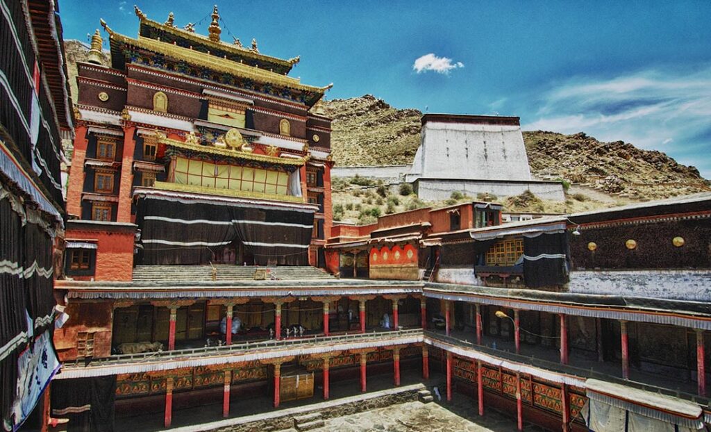
Tashilhunpo Monastery
If you have an extra day, use it to explore Shigatse without turning it into another long-distance excursion. A slower visit can be more rewarding after several days on remote roads. If you are continuing to another destination, confirm the next leg and its permit requirements before leaving Purang; do not assume that reaching Shigatse resolves documentation for onward travel.
Road Conditions, Transport, and Daily Logistics
The word “backroad” can suggest a quiet scenic lane, but on this journey it may mean remote high-altitude roads with limited services and changing surfaces. Depending on the approved route, travelers may encounter paved sections, rougher stretches, construction, gravel, or delays. Conditions can vary by season and after weather events. A capable vehicle, an experienced driver, and a schedule with spare time matter more than a promise of a particular average speed.
Use a vehicle and driver arranged for the route, and ask what contingency support is available if the car develops a problem. Confirm that the vehicle has appropriate tires, basic emergency equipment, and enough capacity for passengers and luggage. Avoid overloading the vehicle; extra weight can make long, rough sections more uncomfortable and can complicate emergency planning.
Fuel, food, and accommodation
Fuel stations and overnight options may be widely spaced in remote areas. Your operator should identify planned refueling stops and confirm that accommodation is available before each travel day. Some nights may be basic compared with city hotels, and room availability can be limited. Ask what bedding, heating, meals, and bathroom facilities to expect so you can pack accordingly.
Carry drinking water and practical snacks, especially for long stretches between towns. Choose foods that travel safely and are easy to eat if a stop is delayed. Do not rely on a particular brand of fuel, restaurant, or lodging being available unless your operator has confirmed it for your dates.
Weather and seasonal flexibility
High-altitude weather can change quickly. Cold, wind, rain, and snow are possible in the mountains and on the plateau, while strong sun can make exposed stops feel hot during the day. Conditions depend on elevation and season, and there is no universally perfect travel window for every route. Ask a local operator which months are suitable for your specific itinerary and what disruptions are common during the period you are considering.
Keep one or more buffer days if your onward flights or train connections are important. Do not schedule a critical departure immediately after a remote road transfer. A delay caused by weather, a road closure, vehicle trouble, or a health issue is possible, and a flexible itinerary is safer than one that assumes every stage will run on time.
Health and Altitude Safety
Altitude is one of the main considerations on a Purang to Shigatse backroad itinerary Tibet. The journey involves high-elevation travel, and travelers can experience altitude illness regardless of fitness. Acclimatize gradually where possible, keep activity light at first, and avoid ascending faster than your body can tolerate. If symptoms worsen, do not continue to a higher elevation without medical guidance.
Speak with a healthcare professional before travel if you have a chronic condition, a history of altitude illness, or questions about medication. A guide is not a substitute for a clinician, and medication should be used only with appropriate medical advice. Confirm in advance how the operator would respond to a medical emergency, where the nearest suitable care may be, and whether evacuation arrangements are available.
Protect yourself from strong ultraviolet exposure with sunglasses, sunscreen, and a hat. Dry air can contribute to dehydration, so drink regularly, while following medical advice if you have a condition that affects fluid intake. Warm clothing is essential even when daytime sun feels strong: temperatures can fall sharply after sunset or during a weather change.
What to Pack for the Journey
Pack for cold nights, bright sun, and days spent in a vehicle. Useful items include layered clothing, a windproof outer layer, comfortable walking shoes, sunglasses, sunscreen, lip balm, personal medication, and a refillable water bottle. Bring a small day bag for essentials and keep valuables, documents, and medication accessible rather than in a large case.
A portable power bank can help when charging opportunities are limited, but do not assume you will have mobile service throughout the route. Download offline maps for general reference and keep your agency’s contact details on paper as well as on your phone. Your guide and approved route information should remain the authority for navigation and access.
Pack snacks that suit your dietary needs, and tell the agency about allergies or food restrictions before departure. If you use prescription medication, bring enough for the planned trip plus a reasonable delay, in its original packaging. Keep passports and permits dry and protected. Avoid packing unnecessary heavy gear; space in a vehicle may be limited, particularly when the trip includes several passengers.
Responsible Travel and Respectful Visits
Remote landscapes can appear untouched, but they are home to communities, wildlife, and culturally important places. Follow your guide’s instructions, remain on permitted roads and paths, and take all litter back with you. Do not disturb animals, collect plants or stones, or leave food waste behind. At monasteries and other sacred sites, move quietly and follow local customs rather than treating the visit as a photo stop.
Buy locally where practical, ask before taking portraits, and respect privacy in villages. Do not photograph checkpoints, security personnel, or restricted facilities. Rules may be enforced differently from one location to another, so ask before using a camera or drone; do not fly a drone unless you have verified that it is permitted and have obtained any required authorization.
Keep expectations realistic. A remote journey may involve waiting, basic facilities, and fewer conveniences than a standard city tour. A considerate pace gives the driver, guide, and local communities room to work safely, and it leaves you more able to appreciate the landscape rather than racing through it.
Before You Confirm Your Itinerary
Ask the agency to answer practical questions in writing: Which route is approved for your travel dates? What permits are included, and what documents must you provide? Where will you sleep each night? How long are the expected driving days? Where are fuel and meal stops planned? What vehicle and emergency arrangements are included? What happens if weather, road access, or altitude symptoms require a change of plan?
Compare the full service details rather than only the headline price. Confirm whether the quoted cost includes guide services, vehicle, driver, accommodation, meals, entrance fees, and permit processing, and identify any exclusions. Check cancellation and delay terms, especially because remote travel can be affected by circumstances outside the operator’s control. Keep copies of confirmations and emergency contacts with you.
A well-planned Purang to Shigatse backroad itinerary Tibet is built around verified access, gradual acclimatization, sensible driving stages, and flexibility. Work with a qualified local operator, confirm the route close to departure, and treat safety and local rules as more important than reaching every planned stop. That approach makes the long crossing easier to manage and gives you a better chance of enjoying the landscapes and cultural encounters along the way.