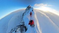

✨Highlights:
- 🌿 Walk the valley often called the most beautiful in the world, on the rarely visited eastern flank of Everest
- 🏔️ See three 8,000-metre peaks in one week: Everest, Lhotse and Makalu, plus Chomo Lonzo at 7,804 m
- 🌸 Descend into Dolshang, the orchid valley, where wild flowers grow beneath the glaciers that feed them
- ⛺ Eight days of supported wild camping, with yaks carrying camp and you carrying only a daypack
- 🥾 Cross the Nangma La at 5,344 m, the high point of the entire route
- 🚵 Hike to the eastern Base Camp of Everest at 5,310 m, a viewpoint almost nobody reaches
- 🛕 Round off with Rongbuk-free culture: Pelkor Chode, Tashilhunpo and Samye-side Lhasa sightseeing
- 🧭 Small groups, Tibetan guides and cook crew, with oxygen and a tested evacuation plan
The valley that makes experienced trekkers go quiet
Ask people who have trekked a lot in Tibet which route they would do again, and the Gama Valley comes up more than any other. It runs along the eastern side of the Everest massif, inside the Everest Nature Reserve, in a trough of land where the Himalayan crest drops from permanent snow at 7,000 metres to forest, meadow and orchid beds within a few days’ walk. The vertical range in this valley is among the most extreme on earth, and because there is no road through it, the number of travellers who have seen its upper reaches is small.
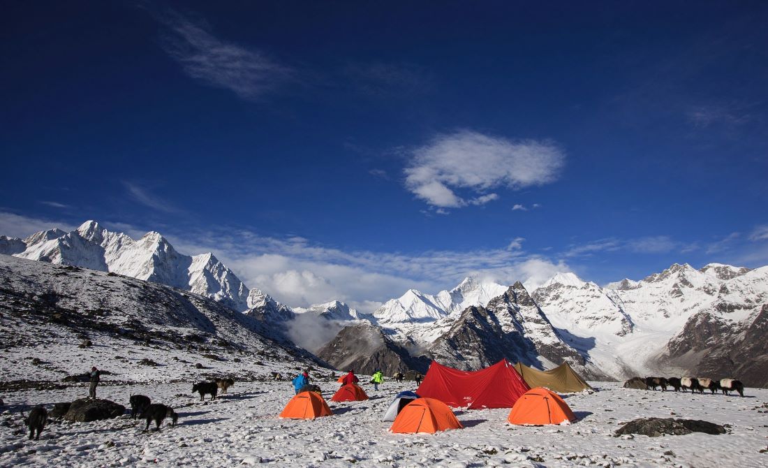
This 15-day Gama Valley trek spends eight days on foot inside that valley. You start at Youpa Village near Tingri, cross the Showo La into the orchid zone, climb through primeval forest to lakes that mirror snow peaks, camp on pastures above 4,900 metres, make a side trip to the eastern Base Camp of Everest, then exit over the Nangma La to Lhundupling. Along the way the skyline includes Everest, Lhotse and Makalu, three of the six highest mountains on the planet, seen from angles that appear in very few photographs.
Reading the skyline: which peak is which
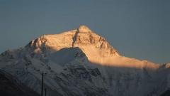
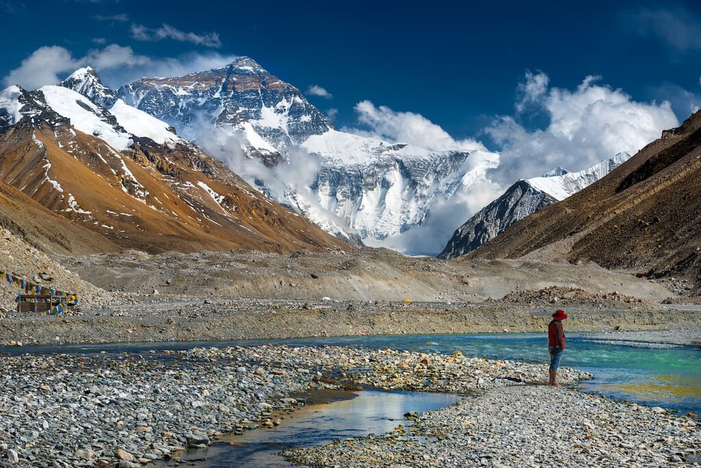
Once you are inside the valley, the mountains stop being a backdrop and become a set of individual characters. Everest, at 8,844 metres, presents its long north-east ridge and the enormous rock wall of the Kangshung face, which from the valley looks less like a summit than like the end of the world. Lhotse, at 8,516 metres, stands immediately south of it, connected by the South Col, and from Gama it appears as a sharp wedge with a hanging glacier on its flank.
Makalu, at 8,463 metres, is the most photogenic of the three from this side: a near-perfect pyramid with ridges running away in three directions, visible for long stretches of the walk from the Dolshang ridge and the Tangsung platform. Chomo Lonzo, at 7,804 metres, is the mountain most travellers cannot name and never forget, a triple-summit massif above the eastern Base Camp that dominates the upper valley.
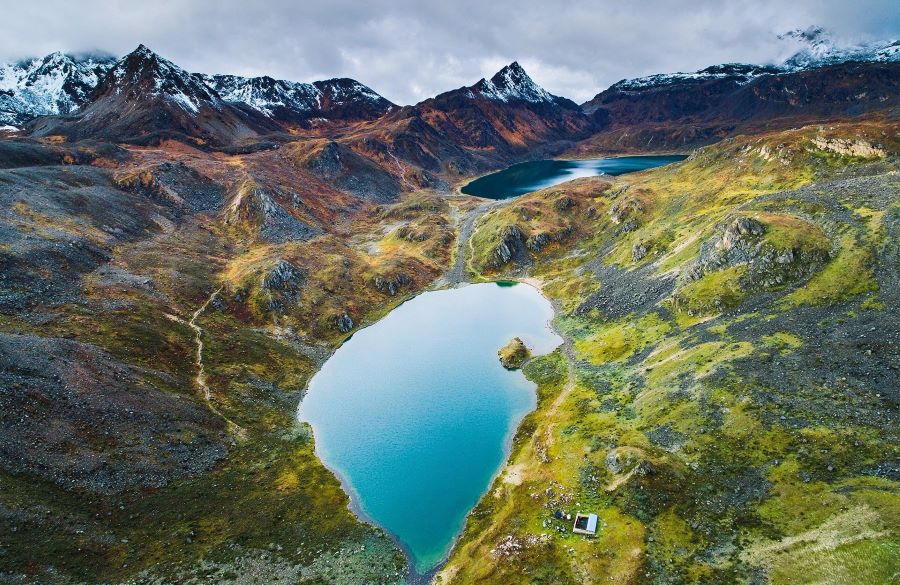
Gama Valley
Ask your guide to point them out at the right moments. The first clear sighting usually comes on trek day three from the ridge above Dolshang, when Makalu appears at the head of the valley, and the full set lines up on trek day seven on the walk to Tsosho-rim, when Everest, Lhotse, Makalu and an unnamed 7,000-metre neighbour stand in a row across the northern horizon. Knowing which is which turns a beautiful view into a memorable one.
It is also a demanding trek. Days run 10 to 21 kilometres with big elevation changes, camps sit between 4,030 and 5,310 metres, and the weather can turn a sunny morning into sleet by two in the afternoon. What it asks of you is fitness, patience and a tolerance for the unpredictable. What it gives back is the best mountain landscape in Tibet that is not already famous.
At a glance
- Duration: 15 days and 14 nights from Lhasa, including 8 trekking days
- Core trek: roughly 110 km on foot inside the Everest Nature Reserve
- Highest sleeping altitude: 5,310 metres at Paltang after the eastern Base Camp excursion, and 5,013 metres at Tsosho-rim
- Highest pass: Nangma La at 5,344 metres
- Difficulty: advanced; previous multi-day trekking at altitude strongly recommended
- Support: licensed guide, cook crew, yak caravan, twin tents, all camp food and equipment
- Best months: May to early June and September to mid-October; the valley is greenest in late June
- Group size: 2 to 12 travellers, private departures available
Days 1 and 2: Lhasa, before the altitude becomes a job
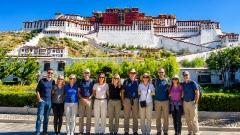
The trip opens gently, on purpose. Day one is arrival, transfer and rest at 3,650 metres, with the hotel’s oxygen supply and humidifier doing quietly useful work overnight. Day two is the classic Lhasa circuit: the Potala Palace in the morning, the Jokhang Temple and Barkhor in the afternoon, and a tea house at dusk.
Use these days to test your gear, finish your shopping and let the guide check your boots, sleeping bag rating and rain layers. Anything missing can still be bought in Lhasa; it cannot be bought in the valley.
Day 3: Lhasa to Shigatse via Yamdrok Lake and Gyantse
A long, spectacular drive west. Gampa La at 4,790 metres delivers the first full view of Yamdrok-tso, ringed by snow and impossibly blue. At the far end of the lake you stop at a village household for lunch, which is the first real conversation of the trip. Then the Karola Glacier, hanging over the highway, and a prayer-flag stop at Simila Pass.
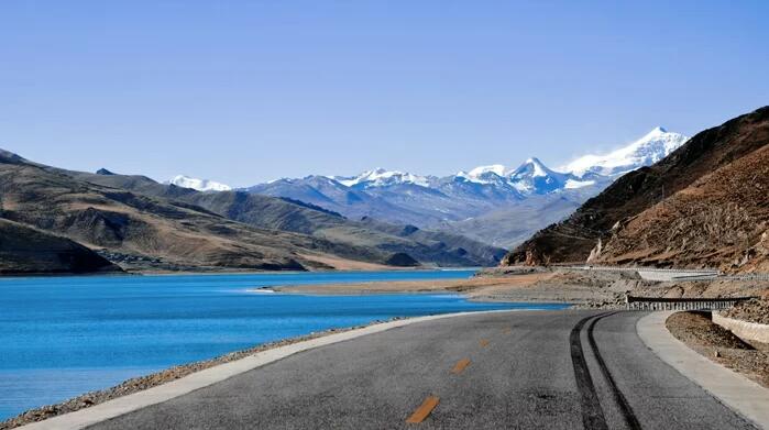
Yamdrok Lake Road
Gyantse brings Pelkor Chode Monastery and the Kumbum Stupa, nine levels and 108 chapels arranged as a mandala in three dimensions. By evening you reach Shigatse at 3,800 metres, with a hotel bed and a hot shower before the trek begins.
Day 4: Shigatse to Tingri to Youpa Village
The drive passes Lhatse and stops at Gyawu La, 5,198 metres, where the Himalayan skyline lays out five 8,000-metre peaks in a row. Then down to the Tingri basin and on to Youpa Village, the trailhead settlement where yaks are registered, loads are weighed and the crew is assembled. Overnight in a village guesthouse at around 4,300 metres, which is the last bed for eight days.
Day 5: Trek Day 1: Youpa to Showo-tso, 10 km, 900 m of gain
The yaks take the loads; you take water, snacks and a camera. The route climbs gently across alpine steppe and rough trail, gaining about 900 metres over ten kilometres, to a camp beside the small, bright Showo-tso pond. This is the day to find your rhythm: short steps, steady breathing, long stops.
Day 6: Trek Day 2: Over the Showo La into the Orchid Valley, 14 km
A 10:00 start, a climb to the Showo La, then a long descent into Dolshang at 4,030 metres, the orchid valley that gives the route its reputation. Streams run beside the trail, shrubs grow thick, and the air carries a sweetness that most trekkers notice before they can identify it. Waterfalls come off the cliffs above camp, and the snow peaks stay visible between the ridges.
Day 7: Trek Day 3: Dolshang to Tsonang-tso to Tangsung, 12 km
A climbing day through untouched forest. The trail works up a ridge with repeated views back across the valley, and on clear days Makalu appears at the head of it. Around noon you reach Tsonang-tso, a lake that drains underground into the valley and reflects the surrounding peaks with an almost unnatural symmetry. After lunch, a pass crossing brings you to the flower-covered Xialong pasture, and then to camp at the Tangsung viewing platform at 4,510 metres.
Day 8: Trek Day 4: Tangsung to Paltang, 11 km
Switchbacks descend towards Badang and the wide Ega grassland, with a deep gorge and the glacier tongues that feed the valley coming into view on the right. The last section crosses big boulder fields, which is slow work and hard on the ankles, to camp at Paltang, 4,950 metres. Rest early; tomorrow is the biggest day.
Day 9: Trek Day 5: Eastern Everest Base Camp, 18 km round trip
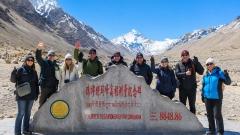
This is the day almost no one else has. From Paltang, the route climbs a steep slope of enormous boulders at roughly 45 degrees to the base camp on Everest’s eastern flank at 5,310 metres. From there you look across at Chomo Lonzo, 7,804 metres, and at the glaciers that hang off the east face of Everest, a view that exists in a handful of published photographs.
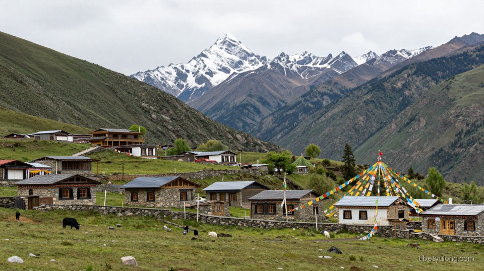
Tashigang Village: A Hidden Gem in Eastern Tibet
The climb is genuinely hard: loose rock, thin air, no fixed path. Anyone who prefers to rest at camp can do so; the valley around Paltang is reward enough. Those who go up return the same way, and camp again at Paltang.
Day 10: Trek Day 6: Back to Tangsung, 14 km
A retracing day, easier in spirit than in effort, following the same trail back to the Tangsung platform. Take it slowly and shoot what you missed on the way in; the light on Makalu in the afternoon is different from the morning.
Day 11: Trek Day 7: Tangsung to Tsosho-rim, 11 km
Northbound now, climbing to a camp beneath big snow peaks at 5,013 metres. The reward arrives in the last hour of walking: Everest at 8,844 metres, Lhotse at 8,516, Makalu at 8,463 and an unnamed 7,000-metre neighbour line up across the horizon.
This is the panorama people carry home in their heads.
Day 12: Trek Day 8: Nangma La and down to Lhundupling, 21 km
The final and longest trekking day crosses two passes: an unnamed one above 5,000 metres and the Nangma La at 5,344 metres, the highest point of the route. Beyond it, the deep blue Latsetso Lake sits in a bowl of scree, and then the trail drops and drops, through high pasture, into the cultivated valley at Lhundupling Village at 3,990 metres. Grass, trees, fields, and the strange sensation of oxygen.
Overnight in a village guesthouse. The trek is over.
Days 13 to 15: Shigatse, Lhasa and the long way home
A scenic drive back to Shigatse, past more Himalayan skyline than anyone needs, then a hot shower and a real dinner. Day 13 returns you to Lhasa along the Yarlung valley with a viewpoint stop over the river. Day 14 is a buffer and free day in the capital, useful if weather delayed the trek. Day 15 is transfer to the airport or station.
What makes this valley different from other Everest treks
Three things. First, the ecology. Because Gama opens north to the plateau and south to the monsoon, it holds rainforest species, rhododendron, orchid beds and alpine tundra within a day’s walk of permanent snow. Nowhere else in Tibet can you photograph flowers, forest, moraine and an 8,000-metre wall in the same frame.
Second, the hydrology. The glaciers on Everest’s east face and Chomo Lonzo feed streams that cut through the valley, disappear underground at Tsonang-tso and reappear lower down. The whole valley is effectively a glacial drainage system you walk inside.
Third, the emptiness. There are no lodges, no teahouses, no vehicle access above Youpa. The only traffic is yaks, herders and the occasional research or climbing party.
Camping, food and daily life on the trek
Camps are twin-share four-season tents with insulating mats, pitched by the crew while you walk. A cook team prepares three meals a day: breakfast with tea, eggs and porridge; a lunch stop with noodles, rice, vegetables and protein; and dinner with soup, rice and something hot and filling. Boiled water is provided; bring a filter bottle as backup. There is no shower for eight days, though a basin of hot water in the evening is a small luxury.
Yaks carry up to about 40 kg each, so packing light matters. One duffel for the yak, one daypack for you.
Altitude: the real difficulty
Camps at 4,950 and 5,013 metres, plus a hike to 5,310 and a pass at 5,344, put this route in the top tier of Tibet treks for altitude exposure. The itinerary’s slow build, with four days above 3,650 metres before the first camp, is the main protection. Beyond that, the rules are unglamorous: walk slowly, drink three to four litres a day, eat even when you are not hungry, sleep when you can, and report symptoms early. The guide carries oxygen, a pulse oximeter and a satellite or mobile plan for evacuation; the valley has exit routes at Youpa and Lhundupling.
If you have had altitude illness before, or a heart or lung condition, this is not the route to test yourself on. Choose the Old Tingri to Base Camp trek or a Lhasa and Namtso itinerary instead, and come back for this one when you have a few more high-altitude nights behind you.
Best season
Late May and June give the greenest valley, running water everywhere, and orchids at their peak, with afternoon cloud and the occasional shower. July and August are wetter, with leeches in the lower forest after heavy rain and cloud hiding the peaks for days. September and October are the best overall: stable air, sharp visibility, golden meadow grass and cold, clear nights. The trek is not run in deep winter.
Permits and logistics
The Tibet Travel Permit plus the Everest Nature Reserve permit are required, and the Alien’s Travel Permit is checked along the Friendship Highway. We handle all of it. The trek portion uses yaks and a local crew hired in Youpa, cooks, tents and food included as listed; hotels in Lhasa and Shigatse are four-star or equivalent with breakfast, and village guesthouses are basic but warm.
Fitness and preparation
Train specifically for endurance: long hill walks with a pack, stairs, cycling, and if possible one multi-day trek at altitude beforehand. Aim to be comfortable walking seven hours on rough ground. Bring boots you have already broken in, a sleeping bag rated to minus fifteen or lower, a four-season shell, and repair tape for everything.
Travelling lightly on a fragile valley
Gama is a protected reserve with slow decomposition and heavy yak traffic. Pack out all rubbish, including food waste and wet wipes. Do not pick orchids, rhododendrons or edelweiss. Keep group sizes small and camps off delicate meadow. Respect herder families: ask before entering a tent or photographing, and do not buy animal products or relics from people who need them more than you do. Use biodegradable soap and keep it away from streams.
FAQ
Is the Gama Valley trek harder than the Everest Base Camp trek in Tibet?
Yes. It is longer, remoter, with higher camps and a much rougher trail, and it has no vehicle support above the trailhead.
How many people will be in the group?
Groups are capped at 12, and private departures are available from 2 travellers. Small numbers are a condition of the permit and of good camping.
Do I need a climbing permit?
No. This is a trekking route inside the reserve; no summit permits are involved.
Can the eastern Base Camp excursion be skipped?
Yes. It is a round-trip from Paltang, and anyone can stay in camp. The altitude there is 5,310 metres, and the climb is the steepest section of the route.
What is the food like after eight days of camping?
Simple and warming: rice, noodles, vegetables, eggs, occasional meat, soup every evening. Vegetarian and gluten-free requirements can be arranged at booking.
Is there any phone signal?
Almost none in the valley, and unreliable at camps. Assume you are offline for eight days and plan accordingly.
Walk the east face with Tibet Yulong
Tibet Yulong is a local operator, and Gama is one of the routes our guides know best: the yak crews, the camp sites, the crossing points and the weather patterns. We keep groups small, build in buffer days, and carry the equipment needed to make eight days in a remote valley feel organised rather than improvised. Write to us with your trekking history and preferred dates, and we will tell you honestly what this route will ask of you, and what it gives back.