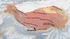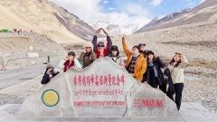

✨ Highlights:
- 🏔️ A genuine multi-day trek on the north side of Everest, from the Tingri plain all the way to Base Camp
- ⛰️ Cross the Lamna La at 5,150 m, one of the hardest and most rewarding climbs on any Tibet trek
- 🐂 Overnight with nomadic herding families and learn how high pasture actually works
- 🛕 Stand at Rongbuk Monastery, the highest monastery in the world, beneath the Everest ice face
- 🌄 Watch five 8,000-metre peaks line up from Gyawu La pass on the drive back
- 🍲 Wild camping under some of the driest, clearest skies in Asia
- 🚐 Comfortable private vehicle, oxygen supply, permit handling and a guide who has walked this route many times
- 🏯 Balance the wilderness with Shigatse, Gyantse and Lhasa, so the trip works as a full Tibet introduction
The south side of Everest has the lodges, the bakeries and the queues. The north side has the Tibetan plateau, a 5,150-metre pass with no switchbacks engineered for comfort, nomadic herders who still move their yaks with the seasons, and a monastery at 4,980 metres where the morning prayer is accompanied by the sound of ice avalanching off the world’s highest mountain.
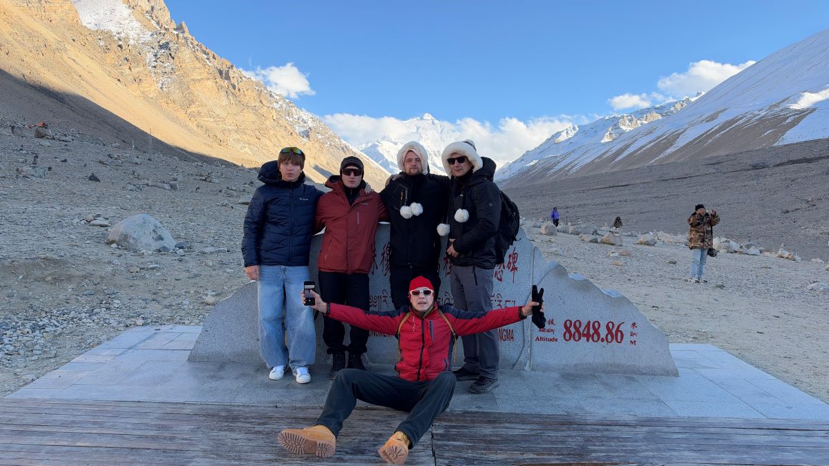
Everest trekking
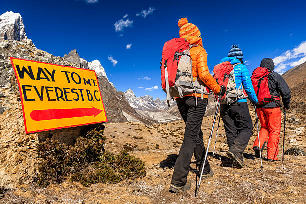
The Old Tingri to Everest Base Camp trek is one of the classic high-altitude walks in Tibet, and it is not a theme park version of one. For four days you move through the Tingri plain and the Ra-chu valley, up to the Lamna La, across the Chaya Pass, and finally to Rongbuk and Base Camp. You carry only a daypack; yaks and a support crew carry the camp. You sleep in tents on pasture used by herders. You spend the last trekking night at a guesthouse within sight of Everest’s north face.
The reward is a perspective most travellers never get: the mountain seen from below, from the east, and from the wide gravel plain that feeds its glaciers, rather than from a viewing platform with a queue behind it.
At a glance
- Duration: 10 days and 9 nights, starting and finishing in Lhasa
- Trekking days: 4 days of walking plus one round-trip excursion, roughly 60 to 70 km in total
- Highest sleeping altitude: about 5,150 metres in the Lamna La valley; Base Camp sits around 5,200 metres
- Highest pass: Lamna La at 5,150 metres, with Chaya Pass and Gyawu La (5,198 m) also above 5,000
- Difficulty: challenging, suitable for fit trekkers with previous multi-day hiking experience
- Best months: May to early June and September to October; July and August are possible but wetter
- Group size: 2 to 12 travellers, private departures available
- Support: guide, cook, yak or porter support, twin tents, all camp equipment
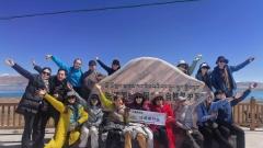
Who this trek suits, and who it does not
This route suits hikers who have done at least one multi-day trek, who are comfortable being cold and dusty for a few days, and who want a mountain rather than a monument as the centrepiece of their trip. It suits photographers, because the light on the north face at sunrise is worth the entire week. It suits travellers who have already been to Tibet once and want to go deeper, as well as first-timers who are physically prepared and honest about their fitness.
It does not suit travellers who need a hot shower every night, who have untreated heart or lung conditions, or who want to reach Base Camp without walking. There is a vehicle route to Rongbuk and Base Camp, and a shorter tour can take you there in comfort; this itinerary earns the arrival on foot.
Days 1 and 2: Lhasa, oxygen and the Potala
Arrival at 3,650 metres sets the pattern for the week: rest, hydrate, sleep. Hotels in Lhasa are equipped with oxygen supply and humidifiers, which makes the first night noticeably easier on the throat and the head. Day two is a full city day: the Potala Palace in the morning, with its chapels, gilded stupas and the meditation cave associated with Songtsen Gampo, the seventh-century king who made Lhasa his capital; then the Jokhang Temple and the Barkhor circuit in the afternoon, finishing with sweet milk tea in a traditional tea house.
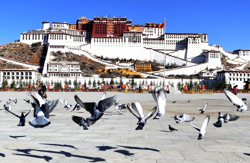
Potala Palace
These two days do double duty. They are the cultural half of the trip, and they are also your acclimatisation. By the time you drive west, your body has already spent three nights at 3,650 metres.
Day 3: Lhasa to Gyantse to Shigatse, over three passes
The drive west is one of the great road journeys of the plateau. You climb to Gampa La at 4,794 metres and the whole of Yamdrok Lake appears below, turquoise and impossibly large, with the Nyenchen Khangsar massif behind it. Further along, Karo La brings you within touching distance of the Karola Glacier, its ice tongue hanging over the road.
In Gyantse you stop at Pelkor Chode Monastery and its Kumbum Stupa, a nine-level, 108-chapel structure that is one of the masterpieces of Tibetan architecture. Every chapel has its own murals, its own deities and its own small doorway; the whole thing is a three-dimensional mandala built in stone. By evening you reach Shigatse, Tibet’s second city, at 3,800 metres.
Day 4: Tashilhunpo Monastery and the road to Old Tingri
The morning belongs to Tashilhunpo, the seat of the Panchen Lama and one of the largest monastic complexes in Tibet, with its whitewashed walls and golden roofs stacked against a bare hill. Then the Friendship Highway carries you west through Lhatse and Shegar, and Cho Oyu, the sixth-highest mountain in the world, appears on the horizon.
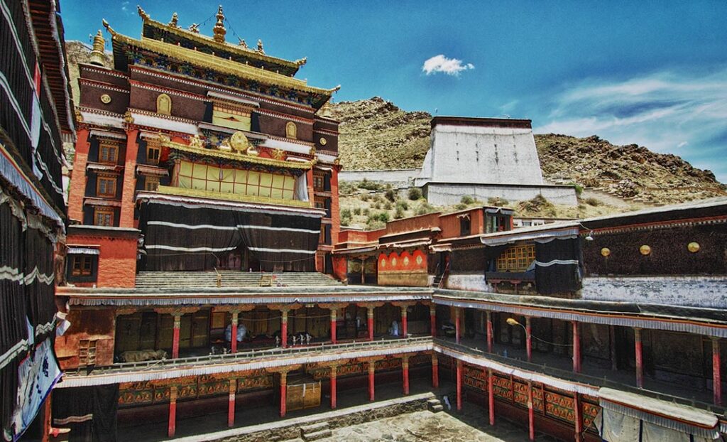
Tashilhunpo Monastery
Old Tingri sits at 4,300 metres on a wide, wind-scoured plain. Your guide completes the final trek preparations here: permits checked, food and fuel loaded, yaks confirmed, tents allocated. The town is small, the hotel is basic, and the sunset over the plain is the sort of thing that makes people quiet.
Day 5: Old Tingri to Lungjiang, 4,510 metres
The trek begins on the Tingri plain, walking north across open ground where the wind is the only sound. The route then enters the Ra-chu valley, where meadows run beside the stream and herds of sheep and goats graze unattended. In the afternoon you visit a small monastery at Choelun, a settlement of herders and barley farmers, and camp nearby at 4,510 metres.
This first day sets the rhythm: four to six hours of walking, a steady pace, long stops for photographs, and a camp that is pitched and ready by the time you arrive. Distance is modest; the altitude is the real work.
Day 6: Lungjiang to the Lamna La, 5,150 metres
This is the hardest day of the trek. The climb to the Lamna La is sustained, mostly uphill, and entirely above 4,700 metres, which means the pace drops to something like a hundred steps, a rest, a hundred more. There is no trick to it. Drink, breathe, keep moving, and let the pass come to you.
At the top, the reward is a 360-degree view of the Himalaya with the Everest massif to the south and the plateau to the north. Then a descent into the Lamna La valley, where camp is pitched on open ground at 5,150 metres. Sleeping this high is the second challenge of the day; most people sleep lightly, and the guide will check on everyone through the evening. Portable oxygen is on hand.
Day 7: Nomad families, Chaya Pass and Zombuk
A gentler day. You stop at the tents of nomadic herding families, drink tea, look at the butter churns and the winter stores, and hear how pasture rotation works on land that supports nothing else. Then the trail crosses the Chaya Pass and descends towards Zombuk village, where camp is set with a view west along a ridge line that turns copper at sunset.
If the weather cooperates, this is the best sunset of the trek. Bring a warm layer and stay out for it.
Day 8: Rongbuk Monastery and Everest Base Camp
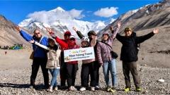
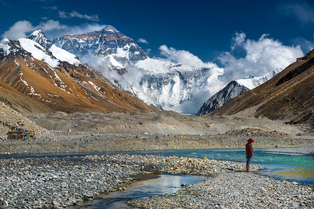
The final walking day is the one you will remember. The trail climbs towards Rongbuk, and Everest’s north face grows from a white triangle on the horizon into a wall of rock and ice that occupies the entire field of view. Rongbuk Monastery, at about 4,980 metres, is the highest monastery in the world: a small complex of white buildings and a courtyard, with monks and caretakers who live here year-round.
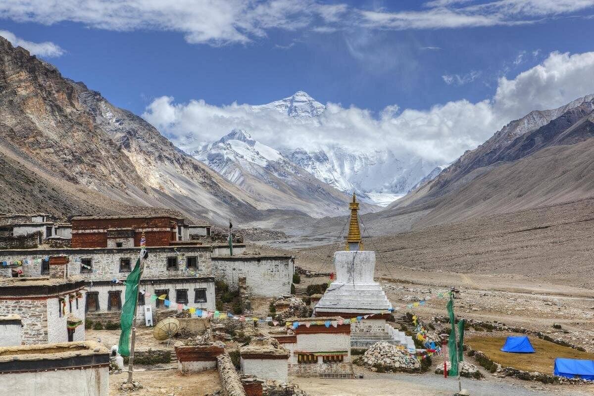
Rongbuk Monastery and Everest
From Rongbuk, the trail continues to Base Camp at around 5,200 metres, on the gravel moraine below the glacier. There is no summit spectacle here, only the base of the mountain and the knowledge of how far above you it continues. Travellers often describe the moment as unexpectedly emotional. Then you check into the Base Camp guesthouse, eat something hot, and watch the last light leave the summit.
Day 9: Gyawu La and the return to Shigatse
A vehicle day, and a spectacular one. The road back east climbs to Gyawu La at 5,198 metres, where the Himalayan skyline opens and five 8,000-metre peaks stand in a row: Everest, Lhotse, Makalu, Cho Oyu and, on a clear day, Shishapangma. It is one of the few places on earth where you can see that many of the highest mountains in a single sweep.
Overnight in Shigatse, with a hot shower and a proper dinner.
Day 10: Back to Lhasa and out
The drive returns you to Lhasa and onward to the airport or the railway station. If your flight is late, there is time for one last walk around the Barkhor.
What the walking actually feels like
Trekking in Tibet is not technical. There is no scrambling, no rope work, no glacier travel on this route. What makes it hard is altitude and weather. Days are warm in the sun and cold in the wind; nights drop below freezing even in summer. The ground is gravel, dirt and grass, with river crossings on footbridges or stepping stones. Camps are on pasture, which means livestock nearby, which means you keep tent zips closed.
The daily rhythm is consistent: wake at first light, hot tea, breakfast, pack, walk four to seven hours with a lunch stop, arrive at camp, tea, rest, dinner, sleep. Yaks carry the camp; you carry water, layers, snacks and a camera.
Altitude strategy on the north side
The itinerary builds altitude gradually: 3,650 in Lhasa, 3,800 in Shigatse, 4,300 at Old Tingri, 4,510 at the first camp, then 5,150. That progression is the reason this route is safer than it looks. Even so, above 5,000 metres the body is working hard, and the guide watches for the signs that mean turn around: headache that will not settle, vomiting, confusion, unusual breathlessness at rest, a cough that persists. We carry oxygen, we have evacuation plans, and we do not treat the summit of a pass as a goal that outranks a person’s health.
Best season for the Tingri trek
May and early June bring dry air, clear skies and strong sun, with cold nights. Late June to August is the monsoon window: the plateau is greener, clouds build in the afternoon, and rain is likely but rarely heavy. September and October are the best months overall, with stable weather, sharp visibility and comfortable daytime temperatures. Winter is possible for experienced, well-equipped trekkers but the passes can close without notice and the wind is severe.
Permits
Foreign travellers need the Tibet Travel Permit, arranged through a licensed local agency; the Everest region also requires an additional permit, and the Alien’s Travel Permit is checked at checkpoints along the Friendship Highway. Bring your passport, your permit and copies, and keep them accessible rather than buried in luggage. Your guide handles the paperwork; what you must do is send documents early and never change your travel dates without telling us.
Food, water and camping comfort
On trek days, meals are prepared by the support crew: porridge, eggs and tea in the morning; noodles, rice, vegetables and sometimes meat at lunch and dinner; boiled water and hot drinks throughout. Vegetarian and allergy requirements are manageable if you tell us at booking. Water is boiled or treated; bring a filter bottle or purification tablets as backup, and avoid untreated stream water regardless of how clean it looks.
Tents are twin-share four-season models with insulating mats; a sleeping bag rated to at least minus fifteen degrees is the single most important item you bring. Base Camp night is in a guesthouse, which is basic but warm.
Fitness and preparation
Train for hills, not distance. Three months of weekly walking with a 8 to 10 kg pack, stairs, or cycling will do more for you than last-minute gym sessions. Practise hiking at a pace you can hold while breathing through your nose. Get a medical check if you are over 60 or have any cardiovascular history.
Travelling with care on nomad land
Ask before photographing people, tents or herds, and accept a no without negotiating. Do not hand out sweets or money to children; if you want to contribute, ask your guide about a family or monastery that genuinely needs it. Pack out all rubbish, including tissues and wrappers, and keep camp sites clean for the next herder who uses the pasture. Stay on established trails across grassland, and keep a respectful distance from livestock and dogs.
FAQ
📋 How fit do I need to be for the Old Tingri to Everest Base Camp trek?
You need to be able to walk five to seven hours a day for four days at altitude. Most trekkers are regular hikers in their thirties to sixties; the common factor is preparation, not age.
📋 Do I need crampons or technical gear?
No. The route is a trekking trail with river crossings and gravel, not a glacier route. Sturdy boots, poles and warm layers are enough.
📋 Can I skip the trekking and still see Base Camp?
Yes. A vehicle-based Everest tour reaches Rongbuk and Base Camp in comfort. This itinerary is for travellers who want the walk.
📋 How cold does it get at night?
From June to September, camps above 4,500 metres typically fall to between minus 5 and plus 5 degrees Celsius. In May and October, minus 10 is normal. A proper sleeping bag matters.
📋 Is there phone signal on the trek?
Intermittent, and mostly absent in the valleys. Treat the trek days as offline time and tell your family in advance.
📋 What happens if someone gets altitude sickness?
The guide assesses symptoms, uses oxygen, and descends if needed. The route has vehicle access at several points, which makes evacuation faster than on remote trails.
Trek Everest’s north side with Tibet Yulong
Tibet Yulong runs this route with Tibetan guides, tested camp logistics and a support crew that has worked these pastures for years. We handle the permits, the yaks, the food and the timing, so your only job is to walk and look. Send us your dates and your hiking history, and we will tell you honestly whether this trek fits you, or whether a shorter Everest itinerary would serve you better.