
Planning a journey to the highest peak on Earth requires more than just physical endurance; it demands careful geographical understanding. A reliable Mount Everest Map is the most crucial tool for any trekker, climber, or curious traveler wanting to navigate the complex terrain of the Himalayas. Whether you are approaching from the lush valleys of Nepal or the arid, sweeping plateaus of Tibet, knowing exactly where you are in relation to the summit can make all the difference. The mountain sits directly on the border between China and Nepal, creating two distinct approaches with vastly different landscapes. Understanding the topography helps travelers prepare for altitude changes, weather shifts, and logistical challenges. This comprehensive guide breaks down everything you need to know about navigating the region using a detailed Mount Everest Map.
Key Takeaways:
- Everest straddles the Nepal-Tibet border.
- South and North routes offer different terrains.
- Base camps serve as primary trekking hubs.
- Khumbu Icefall is a major climbing obstacle.
- Proper maps aid in altitude acclimatization planning.
Understanding the Geography on a Mount Everest Map
To truly appreciate the scale of the Himalayas, one must first understand the geographical context provided by a Mount Everest Map. Mount Everest, known as Sagarmatha in Nepal and Chomolungma in Tibet, stands at an official elevation of 8,848.86 meters (29,031.7 feet). It is part of the Mahalangur Himal sub-range, which stretches across the international border. When you look at a topographical representation of this area, you will notice a massive network of glaciers, deep river gorges, and towering neighboring peaks like Lhotse, Nuptse, and Makalu.
The southern side, located within Nepal’s Sagarmatha National Park, features steep, heavily glaciated valleys that drain into the Dudh Koshi river system. In contrast, the northern side in Tibet presents a drier, wind-swept landscape that gradually rises from the high-altitude plateau. A well-detailed Mount Everest Map illustrates these stark contrasts clearly. Glaciers such as the Khumbu Glacier on the south and the Rongbuk Glacier on the north are prominent features that dictate where trails and climbing routes can be safely established. Understanding these glacial flows is essential because they constantly reshape the terrain, meaning older maps might not reflect current crevasse locations or moraine shifts.
Furthermore, the map highlights the surrounding watershed areas. The melting ice feeds rivers that are vital to millions of people downstream. For trekkers, recognizing these river valleys on the map helps in understanding daily elevation gains and losses, as trails frequently descend into river gorges before climbing up to the next ridge or village.
The South Side: Nepal Trekking Routes on the Mount Everest Map
The most popular way to experience the mountain is via the southern approach in Nepal. When tracing the Everest Base Camp (EBC) trek on a Mount Everest Map, the journey typically begins with a dramatic flight from Kathmandu to Lukla, a small mountain airstrip sitting at 2,860 meters. From Lukla, the trail follows the Dudh Koshi River valley upward.
The route passes through iconic Sherpa settlements such as Phakding, Namche Bazaar, Tengboche, Dingboche, and Lobuche. Namche Bazaar, situated at 3,440 meters, acts as the primary trading hub and acclimatization stop. A good Mount Everest Map will show how the trail weaves in and out of side valleys, crossing suspension bridges and passing ancient monasteries. Tengboche offers the first unobstructed views of Ama Dablam and the Everest massif, serving as a spiritual and visual highlight.
As the trail pushes higher past Dingboche (4,410 meters), the vegetation disappears, replaced by rocky moraines and alpine tundra. The path leads to Gorak Shep, a frozen lake bed at 5,164 meters, which serves as the final resting point before hiking to the South Base Camp at 5,364 meters. Trekkers relying on a Mount Everest Map can easily track their progress, estimate daily hiking times, and identify emergency descent routes if altitude sickness occurs. The map also reveals alternative trekking routes, such as the Gokyo Lakes circuit or the Three Passes Trek, which intersect the main EBC trail and offer less crowded perspectives of the high Himalayas.
The North Side: Tibet Approach on the Mount Everest Map
The northern approach offers a completely different experience, often favored by those who prefer road access over multi-day trekking to reach base camp. On a Mount Everest Map focused on the Tibetan side, the journey usually starts from Shigatse or Lhasa, traveling along the Friendship Highway before branching off toward Tingri and eventually the Rongbuk Valley.
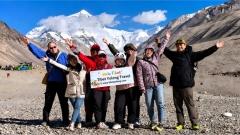
Unlike the rugged, foot-only trails of Nepal, the North Base Camp (situated at approximately 5,150 meters) is accessible by vehicle. The map shows a paved road winding through the barren, high-altitude desert, offering sweeping panoramic views of the north face of Everest without the obstruction of lower foothills. The Rongbuk Monastery, located near the base camp, is marked as a significant cultural landmark on any detailed Mount Everest Map.
For climbers attempting the summit from the north, the map details the route up the East Rongbuk Glacier, leading to the Advanced Base Camp (ABC) at around 6,400 meters. The North Col, a sharp-edged pass carved by glaciers, connects the mountain to Changtse and serves as the gateway to the upper climbing routes. Trekkers and tourists visiting Tibet often use local agencies to arrange permits and transport. Companies like Tibet Yulong Travel specialize in organizing these expeditions, ensuring that visitors have accurate navigational resources, including a reliable Mount Everest Map, proper oxygen supplies, and experienced guides familiar with the unpredictable weather patterns of the Tibetan plateau. Utilizing professional services like Tibet Yulong Travel simplifies the complex permit process required for foreign nationals entering the Tibet Autonomous Region.
Key Landmarks and Climbing Features on the Mount Everest Map
Beyond the trekking routes, a specialized Mount Everest Map used by mountaineers highlights critical technical features that define the climb to the summit. On the South Col route, the Khumbu Icefall is the first major obstacle. Located just above the South Base Camp, this chaotic jumble of shifting ice seracs and deep crevasses requires fixed ropes and aluminum ladders to cross. Maps designate this as a high-danger zone due to constant movement and avalanche risk.
Higher up, the Western Cwm—a broad, flat, gently undulating valley enclosed by Everest, Lhotse, and Nuptse—is clearly marked. Despite its relatively flat appearance on the map, the intense solar radiation reflecting off the snow makes it notoriously hot during the day. Climbers then ascend the Lhotse Face, a steep wall of blue ice that leads to the South Col at 7,906 meters. The South Col is the staging ground for the final summit push.
On the upper reaches, landmarks like the Balcony (8,400 meters), the Hillary Step (a rocky outcrop near the summit), and the Summit Ridge are indicated on detailed climbing charts. While modern GPS devices have largely supplemented paper maps for active climbers, studying a traditional Mount Everest Map remains essential for understanding the spatial relationship between these deadly features. It helps climbers visualize the route, plan their energy expenditure, and understand where supplemental oxygen caches are typically stored.
How to Read Elevation Profiles Using a Mount Everest Map
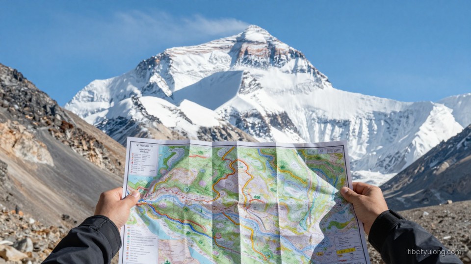
One of the most valuable aspects of studying a Mount Everest Map is interpreting the elevation profiles. Altitude is the primary adversary for anyone entering the Khumbu or Rongbuk regions. Topographic lines, or contour lines, indicate the steepness of the terrain. When contour lines are packed tightly together on the map, it signifies a steep ascent or descent, which requires more time and physical exertion.
For trekkers heading to the South Base Camp, the elevation profile is not a straight line upward. The trail famously follows a “climb high, sleep low” philosophy. You might hike up to 3,800 meters during the day but descend back to 3,440 meters to sleep in Namche Bazaar. A well-designed Mount Everest Map will illustrate these daily fluctuations, helping trekkers understand why a 60-kilometer distance takes roughly eight to twelve days to complete safely.
Understanding the elevation data also aids in predicting temperature drops and weather changes. Generally, the temperature decreases by about 6.5°C for every 1,000 meters gained in elevation. By referencing the altitudes marked on the map, travelers can accurately pack appropriate clothing layers for each stage of their journey. Furthermore, identifying the exact elevations of teahouses and campsites allows trekkers to monitor themselves for symptoms of Acute Mountain Sickness (AMS) and plan rest days accordingly.
Essential Tips for Navigating the Himalayas with a Mount Everest Map
While digital technology has transformed navigation, carrying a physical Mount Everest Map remains a fundamental safety practice in the Himalayas. Batteries die quickly in extreme cold, and electronic screens can become unreadable in direct, high-altitude sunlight. A waterproof, tear-resistant topographical map ensures you always have access to vital route information.
When purchasing or downloading a map, ensure it includes both the main trekking trails and the secondary escape routes. Weather conditions can change rapidly, sometimes forcing trekkers to abandon the main path and seek shelter in lower side valleys. Familiarize yourself with the map’s legend before starting your journey. Understand the symbols used for seasonal streams, permanent glaciers, suspension bridges, and medical posts.
It is also highly recommended to pair your map reading with a basic compass and, if possible, a standalone GPS device loaded with the same topographical data. Discussing your planned route with local guides while reviewing the Mount Everest Map together can provide insights that no printed material can offer. Local knowledge regarding recent trail washouts, new bridge constructions, or temporary camp relocations is invaluable. Ultimately, whether you are embarking on a strenuous trek through Nepal or arranging a comfortable overland tour with Tibet Yulong Travel in Tibet, mastering the geography through a reliable map transforms a daunting expedition into a manageable, deeply rewarding adventure.