
Spanning across some of the most desolate and breathtaking landscapes on Earth, the Xinjiang Tibet Highway is not just a road; it is an epic journey through the roof of the world. Officially known as National Highway 219 (G219), this legendary route connects Yecheng in Xinjiang with Lhatse in Tibet, crossing altitudes that leave even seasoned travelers breathless. It is widely regarded as one of the highest and most dangerous paved roads globally, demanding respect, preparation, and a spirit of adventure from anyone daring enough to traverse it.
Key Takeaways:
- Total distance spans over 2,000 kilometers.
- Average elevation exceeds 4,500 meters above sea level.
- Multiple mountain passes surpass 5,000 meters in altitude.
- Independent travel requires specific permits and meticulous planning.
- Best travel season is strictly between June and September.
Overview of the Xinjiang Tibet Highway Route
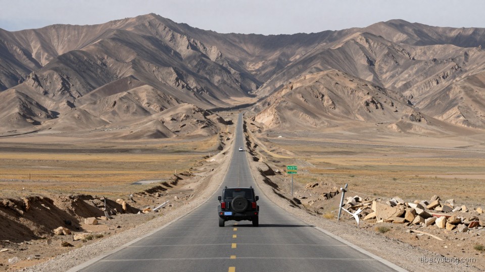
The Xinjiang Tibet Highway serves as the primary overland link between the Xinjiang Uyghur Autonomous Region and the Tibet Autonomous Region. While the original military supply route was established decades ago, continuous upgrades have transformed it into a fully paved highway, though its inherent challenges remain largely unchanged due to the extreme geography. The route officially begins in Yecheng, a county in the Kashgar Prefecture of southern Xinjiang, and terminates in Lhatse County in Tibet’s Shigatse Prefecture, where it intersects with the well-known G318 highway.
Covering approximately 2,140 kilometers, the road cuts directly through the Kunlun Mountains, the Karakoram range, and the vast, uninhabited expanses of the Changtang plateau. Unlike other scenic drives in China, the Xinjiang Tibet Highway offers very little in terms of lush vegetation or dense populations. Instead, travelers are greeted by endless stretches of gravel plains, snow-capped peaks, frozen lakes, and wildlife such as Tibetan antelopes and wild yaks. The sheer isolation of this route means that gas stations, repair shops, and medical facilities are spaced hundreds of kilometers apart, making self-sufficiency a critical requirement for any journey along this corridor.
Essential Stops Along the Xinjiang Tibet Highway
A journey along the Xinjiang Tibet Highway is punctuated by a few remote outposts that serve as vital lifelines for travelers. Understanding these stops is crucial for planning daily driving distances and managing fuel consumption.
Mazar and Dahongliutan
Shortly after leaving Yecheng and ascending into the Kunlun Mountains, travelers reach Mazar, a small settlement situated near the confluence of several rivers. It acts as the first major resting point after the grueling initial climbs. Further south lies Dahongliutan, named after the red willow trees that miraculously survive in this harsh environment. This outpost provides basic accommodation and fuel, marking the transition deeper into the high-altitude desert. The landscape here shifts dramatically, moving from rocky gorges to wide, barren valleys where the wind howls relentlessly throughout the day.
Tianshuihai and Quanshui Lake
Tianshuihai, which translates to “Sweet Water Sea,” is ironically located at an elevation of around 4,850 meters. Despite its name, the water is undrinkable, but the location serves as a crucial military and civilian checkpoint. Nearby, Quansui Lake offers a momentary visual respite, its deep blue waters contrasting sharply with the brown and gray surrounding mountains. These areas are entirely devoid of permanent civilian populations, and the infrastructure exists solely to support transit and border defense operations. Stopping here is usually limited to brief rest periods due to the biting cold and thin air.
Ali (Shiquanhe) and Mount Kailash
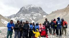
Ali, also known as Shiquanhe or Sengge Zangbo, is the administrative center of the Ngari Prefecture and the largest settlement along the Xinjiang Tibet Highway. For many travelers, reaching Ali feels like arriving in a metropolis after days in the wilderness. It offers modern hotels, hospitals, supermarkets, and reliable fuel stations. From Ali, the highway continues toward the sacred Mount Kailash and Lake Manasarovar, sites of immense spiritual significance for multiple religions. While technically slightly off the main G219 trunk via connecting roads, no journey through this region is complete without acknowledging the profound cultural weight of the Kailash area.
Altitude Challenges and Acclimatization on the Xinjiang Tibet Highway
The most defining characteristic of the Xinjiang Tibet Highway is its staggering elevation profile. The route crosses numerous mountain passes, five of which exceed 5,000 meters, including the infamous Jieshan Pass and Heiqia Pass. The average altitude of the entire journey remains above 4,500 meters, placing immense physiological stress on the human body.
Acute Mountain Sickness (AMS) is not a possibility; it is a near certainty if proper precautions are ignored. Symptoms include severe headaches, nausea, dizziness, shortness of breath, and insomnia. In extreme cases, High Altitude Pulmonary Edema (HAPE) or High Altitude Cerebral Edema (HACE) can develop, both of which are fatal without immediate descent and medical intervention. Because the Xinjiang Tibet Highway ascends relatively quickly from Yecheng, travelers do not have the gradual acclimatization benefits offered by longer approaches from lower elevations.
To mitigate these risks, spending several days in Kashgar or Yecheng prior to departure is highly recommended. Carrying portable oxygen cylinders, pulse oximeters, and medications like acetazolamide (Diamox) under medical guidance is standard practice. Hydration must be maintained constantly, and physical exertion should be kept to an absolute minimum during the first few days on the road. If symptoms worsen rapidly, the only viable treatment is to descend to a lower altitude immediately, which on the Xinjiang Tibet Highway can require hours of driving.
Vehicle Preparation and Driving Conditions
Navigating the Xinjiang Tibet Highway demands a vehicle built for endurance. While the road has been paved, the pavement frequently suffers from frost heaves, washouts, and cracking due to the extreme temperature fluctuations. A robust four-wheel-drive SUV or off-road vehicle with high ground clearance is strongly advised. Sedans and low-clearance vehicles face a high risk of damage to their undercarriages, oil pans, and suspension components.
Before embarking on the Xinjiang Tibet Highway, a comprehensive mechanical inspection is mandatory. Tires should be all-terrain or mud-terrain variants, and carrying two full-sized spare tires is a common safety measure among experienced drivers. The cooling system must be in perfect condition, as engines work significantly harder in thin air, leading to overheating. Extra engine oil, coolant, fan belts, and basic tools for emergency repairs should be secured inside the vehicle.
Fuel management is another critical aspect. Distances between gas stations can stretch beyond 300 kilometers, and stations occasionally run dry due to supply chain disruptions caused by weather or landslides. Carrying approved auxiliary fuel cans ensures you are never stranded. Furthermore, driving at night is strictly discouraged. Wildlife crossings, sudden drops in temperature causing black ice, and the absence of street lighting make nighttime travel on the Xinjiang Tibet Highway exceptionally hazardous.
Permits, Regulations, and Travel Logistics
Traveling the Xinjiang Tibet Highway involves navigating strict bureaucratic requirements, particularly for foreign nationals. Chinese citizens must obtain a Border Pass (Bianfangzheng) to travel through the Ngari Prefecture and border regions. This document is typically arranged in advance in cities like Lhasa, Kashgar, or Yecheng.
For international travelers, independent backpacking along the Xinjiang Tibet Highway is generally prohibited. Foreigners must travel as part of an organized tour with a registered travel agency, accompanied by a licensed guide. They require a Tibet Travel Permit, an Alien Travel Permit, and a Military Area Entry Permit, given the route’s proximity to sensitive international borders. Attempting to bypass these checkpoints results in denied entry, fines, or deportation.
When organizing logistics, partnering with specialized local operators makes a significant difference. Agencies familiar with Tibet Yulong Travel itineraries, for example, understand the nuanced requirements of high-altitude routing. Whether arranging vehicle convoys, securing necessary documentation, or identifying safe overnight stops, leveraging the expertise of professionals who specialize in Tibet Yulong Travel services ensures that the complex logistical puzzle of the Xinjiang Tibet Highway is solved efficiently, allowing travelers to focus on the scenery rather than the paperwork.
Best Time to Travel the Xinjiang Tibet Highway
The window for safely traveling the Xinjiang Tibet Highway is remarkably narrow. Winter and early spring bring catastrophic blizzards, dropping temperatures to minus forty degrees Celsius and burying mountain passes under meters of snow. The road is frequently closed by authorities during these months to prevent travelers from becoming trapped in life-threatening conditions.
The optimal time to undertake this journey is between late June and early September. During this period, daytime temperatures at high altitudes hover above freezing, and the snowmelt has cleared the major passes. However, summer also brings the monsoon influence, meaning afternoon thunderstorms can cause flash floods, mudslides, and temporary road washouts. Even in July, nighttime temperatures can plummet below zero, requiring heavy winter clothing regardless of the season. Travelers must monitor weather forecasts continuously and remain flexible with their itinerary, as delays of several days due to road closures are a normal part of the Xinjiang Tibet Highway experience.
Environmental Responsibility and Cultural Respect
The ecosystems traversed by the Xinjiang Tibet Highway are incredibly fragile. At altitudes exceeding 4,500 meters, plant life grows at a glacial pace, and soil degradation takes decades to reverse. Travelers must adhere strictly to Leave No Trace principles. All waste, including organic matter, must be packed out and disposed of properly in larger towns. Camping outside designated areas damages the permafrost and disrupts local wildlife migration patterns.
Culturally, the route passes through areas deeply sacred to Tibetan Buddhism and indigenous nomadic communities. When encountering mani stones, prayer flags, or chortens, travelers should pass them respectfully, traditionally keeping them to their left. Engaging with local nomads requires sensitivity; always ask permission before taking photographs, and respect their privacy and way of life. The Xinjiang Tibet Highway is more than a transportation artery; it is a corridor through ancient cultures and pristine environments that rely on responsible tourism for their preservation.