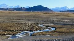

Hidden in the remote southeastern corner of the Tibetan Plateau lies one of the most spectacular natural wonders on Earth. The Yarlung Tsangpo Grand Canyon is not merely a geological formation; it is a profound testament to the raw power of nature. Carved over millions of years by the relentless flow of the Yarlung Tsangpo River, this massive gorge cuts deeply through the Himalayas, creating a landscape that defies imagination. For adventurous travelers and nature enthusiasts, visiting this region offers an unparalleled experience far removed from typical tourist destinations. The sheer scale, the dramatic elevation changes, and the rich cultural tapestry woven into the surrounding villages make it a bucket-list destination. Understanding the canyon requires looking at its unique geography, its incredible ecological diversity, and the practical realities of traveling to such a remote part of the world.
Before diving deep into the details of this magnificent destination, here are the key takeaways you need to know:
- The Yarlung Tsangpo Grand Canyon is the deepest canyon in the world.
- It features a unique horseshoe bend around Mount Namcha Barwa.
- The area hosts diverse ecosystems ranging from alpine ice to subtropical forests.
- Access requires careful planning, permits, and physical preparation.
- Local operators like Tibet Yulong Travel can assist with logistics.
The Geography of the Yarlung Tsangpo Grand Canyon
To truly appreciate the scale of the Yarlung Tsangpo Grand Canyon, one must look at the numbers, which are nothing short of staggering. Stretching for approximately 504 kilometers, it holds the title of the longest canyon in the world. More impressively, its maximum depth reaches over 6,000 meters, making it significantly deeper than the famous Grand Canyon in the United States. The river itself originates high on the Tibetan Plateau from the Angsi Glacier and flows eastward across southern Tibet before making a dramatic, nearly 180-degree turn around the towering peak of Mount Namcha Barwa. This sudden change in direction, often referred to as the Great Bend, is where the river plunges into the deep gorge, carving its way through the Himalayan range to eventually become the Brahmaputra River in India.
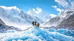
The geological forces that created the Yarlung Tsangpo are still actively at work today. The collision of the Indian and Eurasian tectonic plates continues to push the mountains higher while the river relentlessly cuts downward. This dynamic interplay between uplift and erosion has created steep, almost vertical cliffs, roaring rapids, and hidden waterfalls that remain largely unseen by human eyes. The surrounding peaks, including Namcha Barwa at 7,782 meters and Gyala Peri at 7,294 meters, stand like giant sentinels guarding the entrance to the gorge. The visual contrast between the snow-capped summits and the dark, rushing waters thousands of meters below is one of the most striking landscapes found anywhere on the planet.
Biodiversity Along the Yarlung Tsangpo River
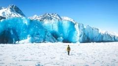
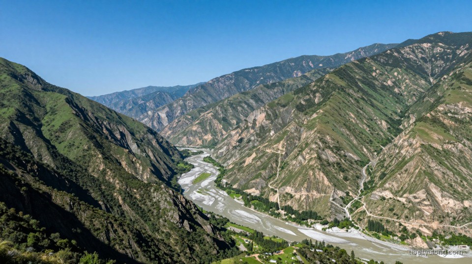
One of the most fascinating aspects of the Yarlung Tsangpo Grand Canyon is its role as a biological corridor. Because the gorge cuts directly through the Himalayas, it acts as a massive funnel, channeling warm, moist air from the Indian Ocean deep into the otherwise arid Tibetan Plateau. This unique climatic phenomenon creates an extraordinary range of microclimates stacked vertically along the canyon walls. At the bottom of the gorge, near the riverbanks, the environment is lush, humid, and subtropical, supporting dense forests of ferns, bamboo, and broadleaf trees. As you ascend the canyon walls, the vegetation transitions through temperate forests of pine and oak, eventually giving way to alpine meadows, shrublands, and finally, permanent glacial ice near the peaks.
This vertical zonation means that within a relatively short horizontal distance, you can find ecosystems that would normally be separated by thousands of kilometers of latitude. Consequently, the Yarlung Tsangpo region is a sanctuary for an incredibly diverse array of wildlife. Rare species such as the snow leopard, the red panda, the takin, and the black-necked crane call these varied habitats home. Botanists consider the area a living museum, harboring numerous ancient plant species that have survived here due to the relatively stable microclimates protected from the harsh extremes of the broader plateau. For researchers and nature lovers alike, the biodiversity sustained by the Yarlung Tsangpo makes it one of the most ecologically significant regions in Asia.
Exploring the Yarlung Tsangpo: Hiking and Routes
Traveling through the Yarlung Tsangpo Grand Canyon is not a casual weekend excursion; it is a serious undertaking that demands respect for the terrain and thorough preparation. The most popular way to experience the canyon is by trekking along its rim or descending into specific accessible valleys. The classic trekking route often begins near the village of Pai, offering stunning vantage points of Mount Namcha Barwa when the weather clears. From there, trails wind through traditional Tibetan and Monba villages, allowing hikers to witness a way of life that has remained largely unchanged for centuries. These paths traverse suspension bridges swaying over turbulent waters, dense forest trails, and exposed ridgelines where the wind can be fierce.
For those who prefer not to undertake multi-day treks, there are designated viewing platforms and shorter walking trails developed for easier access. The Zhibai Village area, for instance, provides excellent panoramic views of the Great Bend without requiring extreme physical exertion. However, venturing deeper into the uncharted sections of the Yarlung Tsangpo remains the domain of professional explorers and scientific expeditions. The lower gorges feature Class V rapids and impassable waterfalls, making river navigation virtually impossible in many stretches. Whether you choose a guided hike along the upper trails or simply visit the established viewpoints, the physical presence of the canyon leaves a lasting impression that photographs cannot fully capture.
Cultural Significance of the Yarlung Tsangpo Region
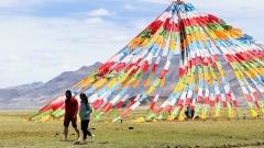
Beyond its geological and ecological marvels, the Yarlung Tsangpo holds profound spiritual and cultural significance for the people of Tibet. In Tibetan Buddhism, the river is considered sacred, and the canyon is deeply intertwined with local mythology and religious practices. Many monasteries and meditation caves are scattered along the upper reaches of the gorge, serving as pilgrimage sites for devout Buddhists. The indigenous communities living in and around the canyon, primarily the Monba and Lhoba peoples, have developed unique cultures adapted to the challenging environment. Their traditional architecture, colorful clothing, and distinct dialects offer a fascinating glimpse into human resilience and adaptation.
The relationship between the locals and the Yarlung Tsangpo is one of deep reverence. The river provides water for agriculture, sustains the forests they rely upon, and shapes the very boundaries of their world. Festivals and rituals are often timed with the seasonal changes of the river, reflecting a harmonious coexistence with nature. When visiting the region, engaging respectfully with these communities adds a rich, human dimension to the journey. Listening to local legends about how the river carved its path through the mountains transforms the landscape from mere rock and water into a living storybook passed down through generations.
Practical Travel Tips for Visiting the Yarlung Tsangpo
Planning a trip to the Yarlung Tsangpo Grand Canyon requires navigating several logistical hurdles. First and foremost, all foreign travelers must obtain a Tibet Travel Permit, which can only be arranged through a registered travel agency. Independent travel in Tibet is generally not permitted, meaning you must be part of an organized tour. Given the remote nature of the canyon, choosing a reliable operator is crucial for both safety and enjoyment. Companies like Tibet Yulong Travel specialize in organizing itineraries that cover the complex permit processes, transportation, and accommodation needs specific to this rugged region. Their local expertise ensures that travelers can focus on the experience rather than the administrative headaches.
Altitude is another major consideration. While the canyon floor drops to relatively low elevations compared to the rest of the plateau, the journey to get there usually involves crossing high mountain passes. Acclimatization is essential to prevent altitude sickness. Travelers should spend several days in Lhasa or Nyingchi adjusting to the elevation before heading toward the Yarlung Tsangpo. The best time to visit is typically during spring or autumn. Spring brings blooming rhododendrons and clearer skies, while autumn offers crisp air and vibrant foliage. Summer months coincide with the monsoon season, bringing heavy rains that can trigger landslides and obscure the mountain views. Proper gear, including sturdy hiking boots, layered clothing, and rain protection, is absolutely necessary regardless of the season.
Transportation to the canyon usually involves flying into Nyingchi Mainling Airport, followed by a scenic drive along winding mountain roads. The infrastructure in the immediate vicinity of the Yarlung Tsangpo is basic but improving, with small guesthouses and eco-lodges replacing older tent camps. Electricity and internet access can be intermittent, so embracing a temporary digital detox is part of the adventure. By preparing adequately and respecting the fragile environment, visitors can safely explore one of the last great wilderness areas on our planet, leaving with memories of a landscape that truly dwarfs human comprehension.