
Driving along National Highway G219 (or the Great Ngari Loop), as you pass through the open high-altitude basins of Purang County, a deep, dark lake immediately catches the eye—this is Lake Rakshastal (La’ang Tso), famously known as Tibet’s “Ghost Lake.”
Lying quietly at the foot of snow-capped peaks right across the road from the renowned sacred Lake Manasarovar, Rakshastal exudes a cold, solitude-filled grandeur. Why is it called the “Ghost Lake”? Can tourists visit it? And what breathtaking sights await travelers here? Here is everything you need to know.
Key Takeaways
- Origin of the “Ghost Lake” Name: Known in Tibetan as La’ang Tso (“The Poisonous Dark Lake”), its eerie reputation comes from its brackish, non-potable water, barren desolate shorelines, and dark, rolling waves even on windless days—rather than ghost legends.
- Open & Accessible to Travelers: Located right off National Highway G219 and right next to Lake Manasarovar, Lake Rakshastal is fully open to tourists, requiring no special entry tickets (only a standard Border Travel Permit).
- Unmissable Scenic Highlights:
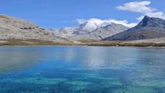
- Deep Ink-Blue Waters: Unlike the bright turquoise of Lake Manasarovar, Rakshastal features a dramatic, deep navy-to-black color palette.
- Reflections of Mount Gurla Mandhata: Offers one of the finest vantage points to photograph Mount Gurla Mandhata (7,694 m) looming over dark, mirror-like waters.
- The “Yin and Yang” Contrast: Positioned side-by-side with sacred Lake Manasarovar, creating a striking natural contrast between vibrant freshwater and desolate saline wilderness.
- Practical Advice: At 4,570 meters above sea level, wind speeds are intense. Visitors should bring heavy windproof gear, avoid drinking the saline water, and prepare for high altitudes.
Why Is It Called the “Ghost Lake”? Unveiling the Mystery
While the name “Ghost Lake” sounds eerie, its origin stems entirely from local geography and natural characteristics rather than supernatural lore:
Bitter Saline Water Unfit for Drinking
Lake Rakshastal is a brackish lake. Unlike neighboring Lake Manasarovar, its water contains higher mineral and salt concentrations, making it bitter to the taste. In harsh high-altitude environments, water that cannot sustain human or livestock consumption was historically referred to by local herders as the “poisonous dark lake” (La’ang Tso).
Barren Shorelines Lacking Vegetation
Due to soil salinity and water composition, almost no grass or plants grow along Rakshastal’s shores. Shorebirds are also rare compared to Manasarovar. The bare, rocky earth paired with dark waters creates a quiet, desolate, and austere atmosphere.
Rolling Waves Without Wind
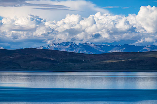
Surrounded by wide plateau terrain, local winds around Rakshastal can be unpredictable. Even on clear days, dark waves often roll across the surface, crashing softly against the dark red shoreline and creating a sense of raw power and solitude.
Can Tourists Visit Lake Rakshastal?
Lake Rakshastal is open to visitors and easily accessible. National Highway G219 runs right beside the lake, where roadside parking areas and viewing platforms allow travelers to pull over, walk toward the shore, and take in the view.
Permit Requirements: Located in Purang County within Ngari Prefecture, Rakshastal sits in a border-control area. Travelers must carry their original ID/Passport (plus Tibet Travel Permit for international tourists) and a Border Travel Permit explicitly listing “Ngari Prefecture” and “Purang County.”
Itinerary Tip: Most travelers pair Lake Manasarovar and Lake Rakshastal together in a single day trip, experiencing the striking contrast between the “Sacred Lake” and the “Ghost Lake.”
Top Scenic Highlights at Lake Rakshastal
Despite its desolate nickname, Rakshastal offers world-class landscapes that thrill photographers and road-trippers alike:
Deep Navy and Ink-Blue Waters
Rakshastal features remarkable water clarity. Influenced by its depth and mineral bed, the lake shifts through deep sapphire, navy, and obsidian hues under the high-altitude sun, resembling a dark gemstone set into the earth.
Premier Vantage Point for Mount Gurla Mandhata
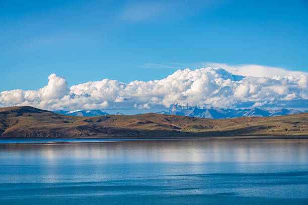
The southern shore of Rakshastal sits right beneath Mount Gurla Mandhata (7,694 meters). Looking south across the water, the towering snow-capped peak stands like a giant wall behind dark blue waves. On clear days, the pyramid peak reflects perfectly onto the lake surface.
The “Yin and Yang” Geographic Contrast
Separated from Lake Manasarovar by only a narrow strip of land and highway (just a few hundred meters wide at its narrowest point), the twin lakes are hydrologically connected underground. One side boasts lush green pastures and peaceful waters, while the other features dark, rolling waves and barren shores—a fascinating display of nature’s contrast.
Practical Travel Tips for Lake Rakshastal
Wind Protection & Warmth: Standing at an altitude of 4,570 meters, lakeside winds are fierce and temperatures drop quickly. Wear windproof outerwear, heavy down jackets, hats, and scarves to prevent catching a cold.
Do Not Drink or Wade: The water is saline and freezing cold. Avoid drinking the water or stepping into the lake barefoot.
Best Photography Time: Late afternoon to dusk is ideal for photographing Rakshastal. The low sun angle enriches the deep water tones, offering a chance to catch golden sunset light illuminating Mount Gurla Mandhata’s snowy summit.
Protect the Wilderness: The high-altitude ecosystem is fragile. Please carry out all trash and leave no trace behind.