
The Tibetan Plateau is the highest and one of the largest elevated regions on Earth, earning it the nickname “Roof of the World.” Stretching across Tibet and several neighboring regions, this immense highland is defined by extraordinary elevation, dramatic mountain ranges, glaciers, grasslands, and some of Asia’s most important rivers. For international travelers, understanding the Tibetan Plateau provides essential context for appreciating Tibet’s landscapes, climate, wildlife, and unique cultural environment.
Key Takeaways
- The Tibetan Plateau covers roughly 2.5 million square kilometers and has an average elevation of more than 4,500 meters.
- It extends across Tibet and parts of Qinghai, Sichuan, Gansu, Yunnan, Xinjiang, India, and Bhutan.
- The plateau is surrounded by major mountain systems, including the Himalayas, Kunlun Mountains, Karakoram, Qilian Mountains, and Hengduan Mountains.
- It is often called the “Roof of the World” and the “Third Pole” because of its immense elevation and freshwater reserves.
- Many major Asian rivers originate on or around the plateau, including the Yangtze, Yellow River, Mekong, Salween, Brahmaputra, and Indus.
- Its high-altitude environment supports distinctive ecosystems, including alpine grasslands and tundra, as well as wildlife such as wild yaks, Tibetan wild donkeys, Tibetan wolves, and snow leopards.
- The plateau’s extreme elevation, dry climate, and vast distances make preparation especially important for travelers visiting Tibet.
Where Is The Tibetan Plateau?
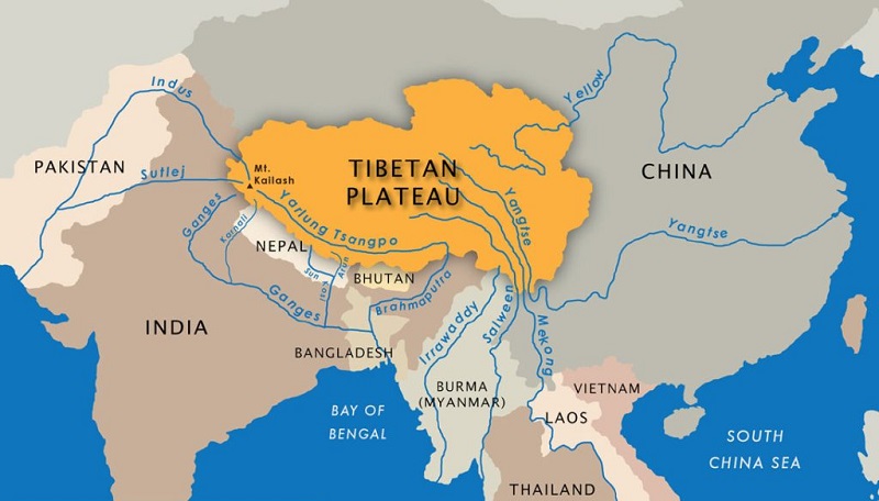
The Tibetan Plateau occupies a vast area of Central and East Asia, with the Tibet Autonomous Region forming one of its most prominent areas. The plateau also extends into neighboring parts of China and beyond China’s borders into regions of India and Bhutan.
Rather than being a single mountain range, the Tibetan Plateau is an enormous high-elevation landscape containing mountains, valleys, grasslands, lakes, glaciers, and river basins. Its immense size is one reason maps of Tibet can look deceptively simple: distances between major destinations can be much greater than they appear.
The plateau stretches approximately 2,500 kilometers from east to west and reaches a maximum width of about 1,000 kilometers from north to south. Its geographical position places it between some of Asia’s most important mountain and desert regions.
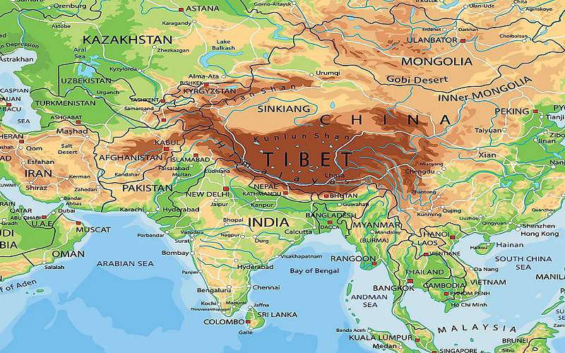
To the north, the Kunlun Mountains and related ranges form a major boundary. The Qilian Mountains lie toward the northeast, while the Himalayas and Karakoram dominate the southern and southwestern edges. To the southeast, the Hengduan Mountains connect the plateau with the mountainous landscapes of southwestern China.
This geography gives the Tibetan Plateau a remarkably distinct identity. It is not simply a high mountain region; it is an enormous elevated landmass surrounded and shaped by some of the world’s greatest mountain systems.
Tibetan Plateau Map
Why Is The Tibetan Plateau Called The Roof Of The World?
The nickname “Roof of the World” comes primarily from the plateau’s extraordinary elevation. With an average altitude exceeding 4,500 meters, large parts of the region are higher than many mountain summits elsewhere on Earth.
The elevation is immediately noticeable to visitors. Travelers arriving in Lhasa, for example, may already find themselves more than 3,600 meters above sea level, while destinations farther west can rise considerably higher. Mountain passes, lakes, valleys, and settlements across the plateau frequently sit at elevations that would be considered extreme in most other parts of the world.
The plateau’s height also influences almost everything about its environment. Thin air, strong sunlight, low humidity, large temperature differences between day and night, and relatively limited vegetation are all connected to its elevation.
The surrounding mountains make the landscape even more dramatic. From a traveler’s perspective, the combination of enormous open spaces and distant snow-covered peaks creates one of the most distinctive visual environments in Asia.
The Major Mountain Ranges Around The Plateau
The Tibetan Plateau is surrounded by several major mountain systems. These ranges form natural geographical boundaries while also influencing climate, water flow, transportation, and human settlement.
The Himalayas
The Himalayas form the southern edge of the Tibetan Plateau and create one of the world’s most spectacular geographical boundaries. The range separates the high Tibetan Plateau from the lower plains of the Indian subcontinent.
Mount Everest, the world’s highest mountain, rises along this Himalayan frontier. Other famous peaks and glaciers contribute to the extraordinary landscape along the southern edge of Tibet.
For travelers, the Himalayan region is one of the most accessible ways to experience the relationship between the plateau and the mountains surrounding it. Routes toward Mount Everest from Tibet reveal how the enormous highland gradually meets the world’s highest mountain range.
The Kunlun Mountains
To the north, the Kunlun Mountains separate much of the Tibetan Plateau from the Tarim Basin. This northern landscape is generally more remote and rugged, with vast high-altitude terrain and relatively sparse human settlement.
The Kunlun system is particularly important for understanding why the plateau has such a dramatic northern boundary. Beyond the mountains, the landscape transitions toward the arid basins and deserts of northwestern China.
The Qilian Mountains
The Qilian Mountains lie along the northeastern side of the Tibetan Plateau. They form a geographical transition between the plateau and areas associated with the Gobi Desert and the Hexi Corridor.
This region has historically been significant for transportation and cultural exchange between the Tibetan Plateau and northern China.
The Karakoram And Hengduan Mountains
The Karakoram Mountains influence the western and southwestern landscape around the plateau, while the Hengduan Mountains dominate parts of eastern and southeastern Tibet and connect the plateau with Yunnan and surrounding regions.
Together, these mountain systems create the geographical framework that surrounds the Tibetan Plateau and helps explain its distinctive climate and landscapes.
Tibet Autonomous Region
The Tibetan Plateau And Asia’s Great Rivers
One of the most important characteristics of the Tibetan Plateau is its role as a major source of freshwater for Asia. The plateau is sometimes described as the “Third Pole”, reflecting the enormous concentration of glaciers, snow, wetlands, and other freshwater resources outside the Arctic and Antarctic polar regions.
Several major rivers originate on or around the plateau and then flow across China and other parts of Asia.
The Yangtze River begins in the highlands before flowing eastward across China. The Yellow River also has its source in the broader Tibetan Plateau region, while the Mekong and Salween flow southward toward mainland Southeast Asia.
The Yarlung Tsangpo, one of Tibet’s most important rivers, travels eastward across the plateau before continuing toward South Asia, where it is known as the Brahmaputra. The Indus also has its source in the high-altitude region around western Tibet.
These rivers make the Tibetan Plateau important far beyond its geographical boundaries. Water originating in these highlands supports ecosystems, agriculture, communities, and cities across a huge part of Asia.
For visitors, this relationship between mountains, glaciers, lakes, and rivers becomes especially visible when traveling through western and southern Tibet. Sacred lakes and high-altitude river valleys are not isolated features; they form part of a much larger water system shaped by the plateau.
Lake Manasarovar And The Sacred Landscape
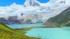
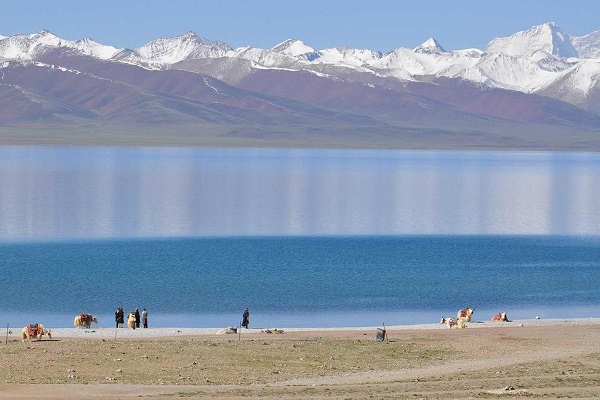
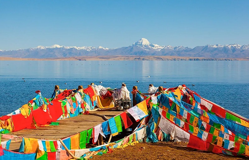
Among the many lakes of the Tibetan Plateau, Lake Manasarovar is particularly significant. Located in western Tibet near Mount Kailash, the high-altitude freshwater lake has been revered for centuries by Buddhist and Hindu pilgrims.
The landscape around Lake Manasarovar demonstrates several defining characteristics of the plateau: extreme elevation, expansive open terrain, snow-covered mountains, clear skies, and an environment shaped by glaciers and seasonal water cycles.
The lake is also closely associated with the spiritual geography of Mount Kailash. Together, the mountain and lake form one of the most important pilgrimage landscapes in Tibet.
For travelers, visiting this part of the plateau is very different from exploring Lhasa. Western Tibet is far more remote, and journeys involve long road sections, high mountain passes, and limited infrastructure. Yet that remoteness is also part of its appeal.
Lake Mansarovar and Mount Kailash
How Was The Tibetan Plateau Formed?
The Tibetan Plateau has a geological history stretching back tens of millions of years. Its formation is closely related to the collision between the Indian and Eurasian tectonic plates.
As the Indian Plate moved northward, it collided with the Eurasian Plate. The immense forces generated by this collision compressed and uplifted Earth’s crust, contributing to the formation of both the Tibetan Plateau and the Himalayan mountain system.
The geological process did not end millions of years ago. The region remains tectonically active, and the continuing interaction between the plates contributes to ongoing uplift and deformation.
This geological history helps explain why the plateau contains such extraordinary combinations of high mountains, broad basins, deep valleys, fault systems, glaciers, and sedimentary landscapes.
For visitors interested in geology, the plateau is essentially a vast natural record of continental collision. A journey across Tibet can reveal dramatic changes in terrain over relatively short distances, from broad grasslands to enormous mountain walls and deeply carved river valleys.
Climate Of The Tibetan Plateau
The Tibetan Plateau has a predominantly high-altitude, dry climate, although conditions vary considerably across its enormous area.
The plateau receives relatively little precipitation compared with many surrounding regions. The Himalayas act as a major barrier to moisture-bearing winds from the south, contributing to the dry conditions across much of the interior.
Annual precipitation in many areas is relatively low, while summer rainfall is influenced by the Asian monsoon. Snow, hail, and strong winds can occur even during periods when temperatures appear moderate at lower elevations.
Temperature is another defining feature. Average annual temperatures across the plateau can be surprisingly low considering its location in Asia, and the difference between daytime and nighttime temperatures can be substantial.
The Changthang region in northern Tibet is among the coldest and most remote areas. Winter temperatures can become extremely severe, while large areas remain covered by permafrost.
For international travelers, this climate has practical consequences. A sunny afternoon does not necessarily mean warm conditions after sunset, and high-altitude sunlight can feel intense even when the air remains cold. Layered clothing, sun protection, hydration, and proper acclimatization are essential when traveling at altitude.
Flora Of The Tibetan Plateau
Vegetation on the Tibetan Plateau is strongly influenced by altitude, temperature, moisture, and local terrain.
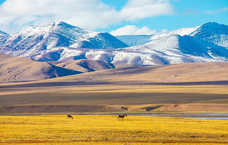
Montane grasslands are among the most widespread ecosystems. In colder and higher areas, alpine tundra vegetation dominates, while regions affected by greater moisture can support shrubs and forests.
The southeastern parts of the plateau generally receive more moisture than the northern and western interior. As the landscape descends toward areas such as Nyingchi and the Hengduan Mountains, forests become increasingly prominent.
This creates remarkable contrasts within Tibet. A traveler can move from dry, nearly treeless highlands into forested valleys without leaving the broader geographical system of the Tibetan Plateau.
Plant life is also important to local communities. Pastoralism, agriculture, medicinal plants, and other natural resources have long been connected with life on the plateau.
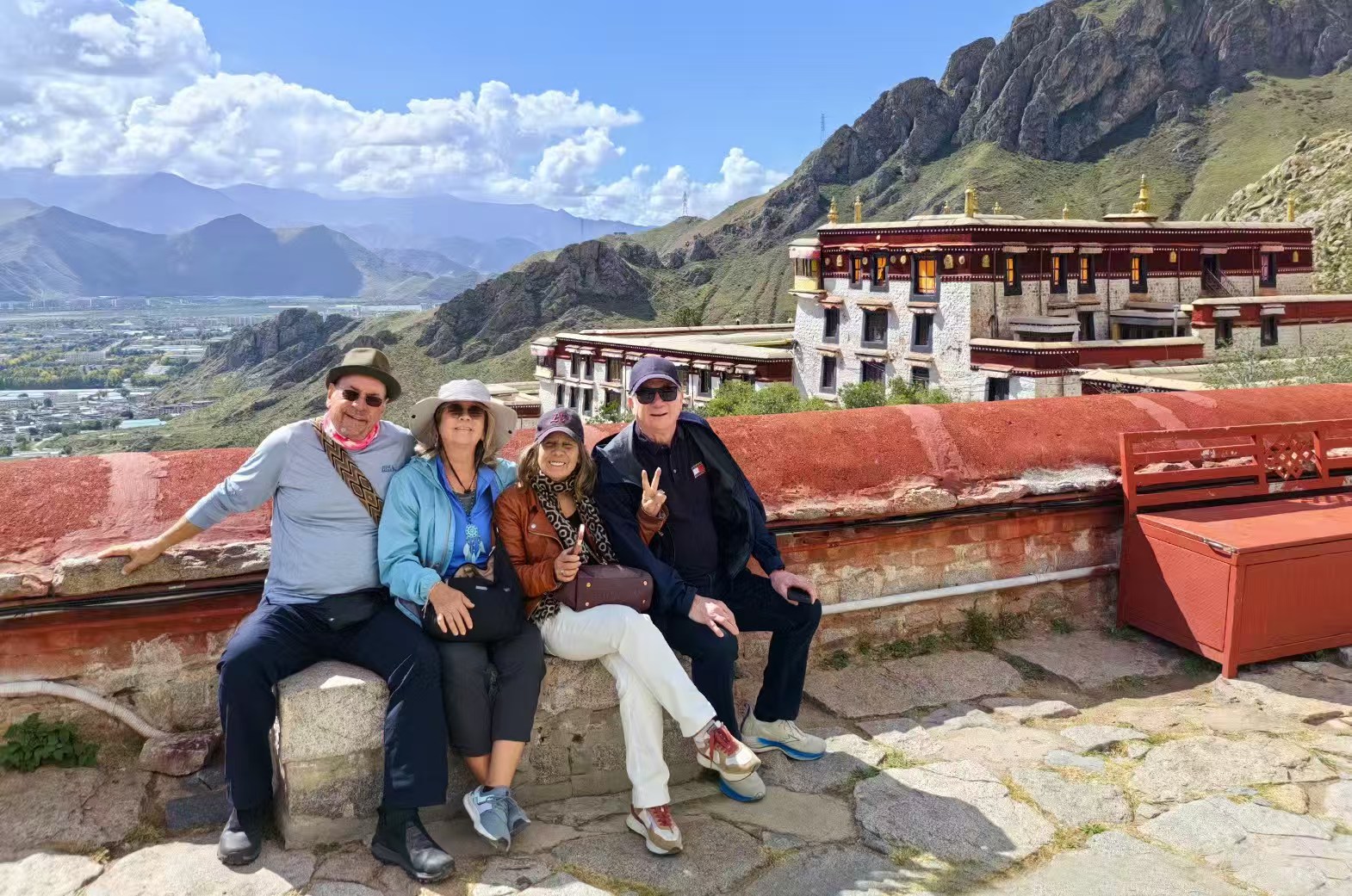
Tibetan Plateau
Wildlife Of The Tibetan Plateau
Despite its harsh environment, the Tibetan Plateau supports an impressive variety of wildlife.
Among its most famous animals are the wild yak, Tibetan wild donkey, Tibetan wolf, snow leopard, and Tibetan fox. Large birds such as vultures, hawks, geese, and cranes can also be found in suitable habitats.
The plateau’s wildlife has adapted to thin air, cold temperatures, limited vegetation, and enormous seasonal changes. Some species have developed highly specialized physiological and behavioral adaptations to survive at extreme elevations.
The snow leopard is particularly symbolic of the Himalayan and Tibetan highlands. Although rarely seen by travelers, its presence represents the ecological importance of the remote mountain environment.
Wildlife encounters should always be approached responsibly. Visitors should keep their distance, avoid feeding animals, and follow local regulations, particularly in protected areas.
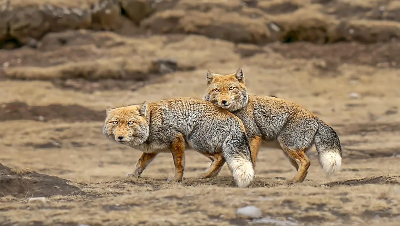
Tibetan Fox in the Tibetan Plateau
Why The Tibetan Plateau Matters To Travelers
The Tibetan Plateau is more than a geographical destination. Its extraordinary environment shapes nearly every aspect of a Tibet journey.
The high altitude affects how visitors acclimatize. The mountains determine travel routes. Rivers and lakes create some of the region’s most memorable landscapes. Climate influences when different areas are accessible. Meanwhile, centuries of Tibetan culture have developed in close relationship with this demanding environment.
Popular journeys can include cultural exploration around Lhasa, visits to historic monasteries in Shigatse and Gyantse, Himalayan scenery around Mount Everest, and long overland adventures toward Mount Kailash and Lake Manasarovar.
Each route reveals a different part of the plateau.
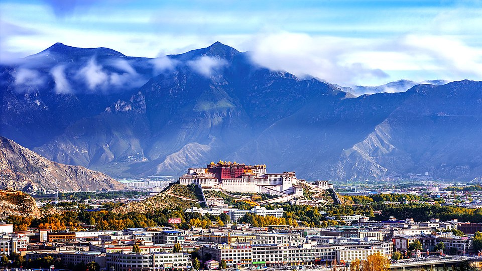
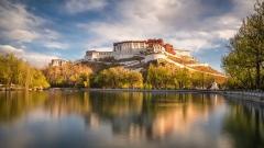
Potala Palace
Tibetan Plateau Travel And Altitude
Altitude is one of the most important considerations when visiting the Tibetan Plateau. Travelers who arrive from low elevations may need time to adjust before undertaking demanding activities.
Lhasa itself is already at a high elevation, and many popular destinations are considerably higher. Mountain passes and western Tibet routes can exceed 5,000 meters.
A sensible itinerary should therefore allow time for acclimatization rather than attempting to cover too much ground immediately after arrival.
Travelers should also remember that physical fitness and altitude acclimatization are not the same thing. Being physically fit does not automatically eliminate the effects of thin air.
For this reason, reputable local travel planning is particularly valuable in Tibet. Routes, accommodation, driving times, altitude changes, and rest periods should all be considered together.
Exploring The Tibetan Plateau With Tibet Yulong Travel
For international visitors, experiencing the Tibetan Plateau is about more than reaching a famous attraction. The real journey lies in understanding how its mountains, rivers, wildlife, climate, and Tibetan culture fit together.
Tibet Yulong Travel specializes in Tibet journeys for international travelers and can help organize routes that combine cultural landmarks with the dramatic natural landscapes of the plateau. Depending on the itinerary, travelers can explore Lhasa and its monasteries, travel toward Mount Everest, visit sacred lakes, or venture farther west toward Mount Kailash and Lake Manasarovar.
A local Tibet travel team can also help travelers plan appropriate acclimatization schedules and transportation arrangements, which are especially important when crossing such a high and expansive region.
Frequently Asked Questions About The Tibetan Plateau
How Large Is The Tibetan Plateau?
The Tibetan Plateau covers approximately 2.5 million square kilometers and extends roughly 2,500 kilometers from east to west, with a maximum width of around 1,000 kilometers.
How High Is The Tibetan Plateau?
Its average elevation is generally described as more than 4,500 meters above sea level, making it the highest major plateau on Earth.
Why Is The Tibetan Plateau Called The Third Pole?
The plateau contains enormous quantities of snow, glaciers, permafrost, wetlands, and freshwater. Its importance as a high-altitude freshwater reservoir has led to the nickname “Third Pole.”
Which Major Rivers Begin On The Tibetan Plateau?
Major river systems associated with the plateau include the Yangtze, Yellow River, Mekong, Salween, Yarlung Tsangpo/Brahmaputra, and Indus, among others.
Is The Tibetan Plateau Always Cold?
No. Conditions vary significantly by location, elevation, season, and weather patterns. However, high elevation produces generally cool temperatures, strong day-night temperature differences, and severe winters in many areas.
Can Tourists Visit The Tibetan Plateau?
Yes. Tibet is a major destination for international tourism, with popular routes including Lhasa, Shigatse, Mount Everest, Nyingchi, and western Tibet. Because of the region’s high altitude and travel regulations, international visitors should arrange their journey through an appropriately licensed local travel agency and prepare carefully for the conditions.